desalinizadora de Santa Eulalia
desalinizadora de Santa Eulalia is a waterworks in Santa Eulària des Riu, Balearic Islands, Balearic Islands. desalinizadora de Santa Eulalia is situated nearby to the park Camp CIFP Can Marines, as well as near the beach Platja des Niu Blau.| Tap on a place to explore it |
Places of Interest Nearby
Highlights include Platja des Niu Blau and Cala Pada.
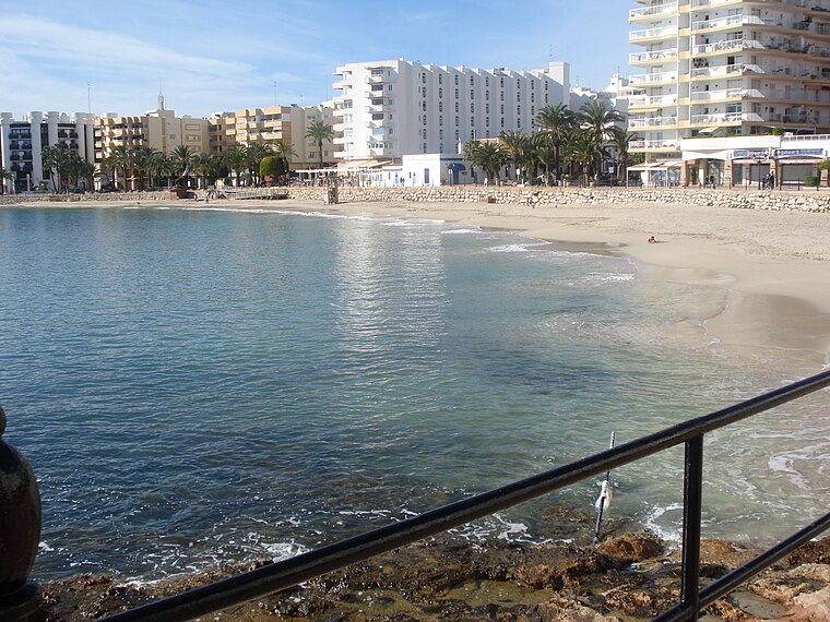
Platja des Niu Blau
Beach

Photo: Saoro, Public domain.
Platja des Niu Blau is a beach in the south east seaboard of the Spanish island of Ibiza. It is part of the municipality of Santa Eulària des Riu and is located 1.4 miles east of the town of Santa Eulària des Riu, and 2.0 miles west of the beach resort of Es Canar.
Cala Pada
Beach

Photo: Ms61, Public domain.
Cala Pada is a beach on the south east seaboard of the Spanish island of Ibiza. It is in the municipality of Santa Eulària des Riu and is 2.7 miles east of the town of Santa Eulària des Riu, and 1.9 miles south west of the beach resort of Es Canar. Cala Pada is situated 1¼ km east of desalinizadora de Santa Eulalia.
Places in the Area
Nearby places include Santa Eulària des Riu and Es Canar.
Santa Eulària des Riu
Town

Photo: UnFUG-Fabi, CC0.
Santa Eulària des Riu is a coastal town on the south eastern coast of the Spanish island of Ibiza. The town is located on the designated road EI-200. Santa Eulària is the third largest town on the island and also has the only river on the island which flows into the sea at the western end of the town.
Es Canar
Village

Photo: UnFUG-Fabi, CC0.
Es Canar is a beach resort village on the Spanish island of Ibiza. The resort is in the municipality of Santa Eulària des Riu. The resort is reached along the street called Cami d'Escana from Santa Eulària des Riu. Es Canar is situated 2½ km east of desalinizadora de Santa Eulalia.
Cala Llenya
Village

Photo: Dreizung, CC BY-SA 4.0.
Cala Llenya or Cala Lleña is a small resort village and beach on the northeastern coast of Ibiza. Cala Llenya and Cala Boix often have "choppy waves." To the north is Cala Mastella. Cala Llenya is situated 4½ km northeast of desalinizadora de Santa Eulalia.
desalinizadora de Santa Eulalia
- Type: Waterworks
- Category: industry
- Location: Santa Eulària des Riu, Balearic Islands, Ibiza, Balearic Islands, Spain, Iberia, Europe
- View on OpenStreetMap
Latitude
38.99463° or 38° 59′ 41″ northLongitude
1.54664° or 1° 32′ 48″ eastOpen location code
8FC3XGVW+VMOpenStreetMap ID
way 1393231433OpenStreetMap feature
man_made=water_works
This page is based on OpenStreetMap, Wikidata, and Wikimedia Commons.
We’d love your help improving our open data sources. Thank you for contributing.
Satellite Map
Discover desalinizadora de Santa Eulalia from above in high-definition satellite imagery.
Notable Places Nearby
Highlights include Camp CIFP Can Marines and Polideportivo Municipal Santa Eulalia.
Nearby Places
Explore places such as EDAR de Santa Eulària des Riu and Eroski.
Ibiza: Must-Visit Destinations
Delve into Ibiza and Sant Antoni de Portmany.
Curious Waterworks to Discover
Uncover intriguing waterworks from every corner of the globe.
About Mapcarta. Data © OpenStreetMap contributors and available under the Open Database License". Text is available under the CC BY-SA 4.0 license, except for photos, directions, and the map. Photo: Kayman2016, CC BY-SA 4.0.