Reitsportzentrum Fehmarn
Reitsportzentrum Fehmarn is a recreation area in Fehmarn, Ostholstein, Schleswig-Holstein which is located on Am Reitsportzentrum. Reitsportzentrum Fehmarn is situated nearby to the public building Rettungswache Burg, as well as near the sports venue Sporthalle.| Tap on a place to explore it |
Places of Interest Nearby
Highlights include Rathaus Burg auf Fehmarn and Meereszentrum Fehmarn.
Rathaus Burg auf Fehmarn
Town hall
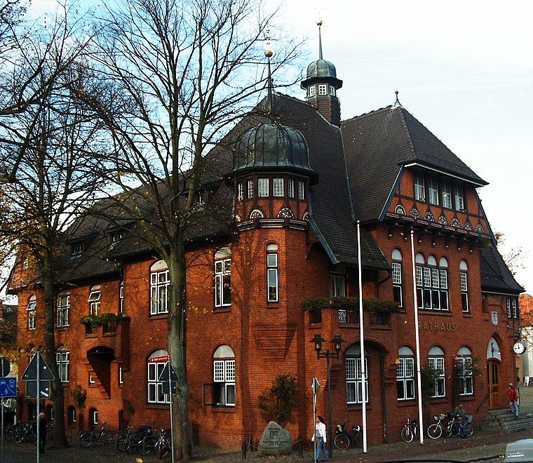
Photo: S.moeller, Public domain.
Rathaus Burg auf Fehmarn is a town hall, which is situated 1¼ km southwest of Reitsportzentrum Fehmarn.
Meereszentrum Fehmarn
Public aquarium

Photo: Thomas Kroemer, CC BY-SA 4.0.
Meereszentrum Fehmarn is a public aquarium, which is situated 1½ km west of Reitsportzentrum Fehmarn.
St. Nicholas Church, Fehmarn
Church

Photo: Beckstet, CC BY-SA 3.0.
St. Nicholas Church is a church in the city of Burg on the German Baltic island of Fehmarn. St. Nicholas Church, Fehmarn is situated 1½ km southwest of Reitsportzentrum Fehmarn.
Places in the Area
Nearby places include Burg auf Fehmarn and Burgstaaken.

Burgstaaken
Suburb

Photo: Hajotthu, CC BY-SA 3.0.
Burgstaaken is a suburb, which is situated 2½ km south of Reitsportzentrum Fehmarn.
Landkirchen auf Fehmarn
Village

Photo: Torbenbrinker, CC BY-SA 3.0.
Landkirchen auf Fehmarn is a village, which is situated 3½ km west of Reitsportzentrum Fehmarn.
Reitsportzentrum Fehmarn
- Type: Equestrianism
- Address: Am Reitsportzentrum 4, Fehmarn, 23769
- Categories: recreation area and sports location
- Location: Fehmarn, Ostholstein, East Holstein, Schleswig-Holstein, Germany, Central Europe, Europe
- View on OpenStreetMap
Latitude
54.44781° or 54° 26′ 52″ northLongitude
11.20599° or 11° 12′ 22″ eastInception
May 1st, 2025Operator
Fehmarnscher Ringreiterverein e.V.Open location code
9F6HC6X4+49OpenStreetMap ID
way 1393932160OpenStreetMap feature
leisure=horse_riding
This page is based on OpenStreetMap, Wikidata, and Wikimedia Commons.
We’d love your help improving our open data sources. Thank you for contributing.
Satellite Map
Discover Reitsportzentrum Fehmarn from above in high-definition satellite imagery.
Notable Places Nearby
Highlights include Rettungswache Burg and Sporthalle.
Nearby Places
Explore places such as Charleston, Wohn- und Pflegezentrum and Burg auf Fehmarn, Niendorfer Weg.
East Holstein: Must-Visit Destinations
Delve into Lübeck, Ratzeburg, Timmendorfer Strand, and Grömitz.
Curious Places to Discover
Uncover intriguing places from every corner of the globe.
About Mapcarta. Data © OpenStreetMap contributors and available under the Open Database License". Text is available under the CC BY-SA 4.0 license, except for photos, directions, and the map. Photo: Wikimedia, Public domain.