Hardwick STW
Hardwick STW is a wastewater treatment plant in Hardwick, Wellingborough District, England. Hardwick STW is situated nearby to Church of St Leonard, as well as near the forest Vivian’s Covert.| Tap on a place to explore it |
Places of Interest Nearby
Highlights include Sywell Aerodrome and Sywell Aviation Museum.
Sywell Aerodrome
Aerodrome

Photo: Wikimedia, CC BY-SA 3.0.
Sywell Aerodrome is the local aerodrome serving the towns of Northampton, Wellingborough, Kettering and Rushden, as well as wider Northamptonshire. The aerodrome is located 5 nautical miles northeast of Northampton and was originally opened in 1928 on the edge of Sywell village. Sywell Aerodrome is situated 2 miles southwest of Hardwick STW.
Sywell Aviation Museum
Museum
Sywell Aviation Museum is based at Sywell Aerodrome in Northamptonshire, England. It is sited in the aircraft viewing car park at the aerodrome. It documents the history of flying in Northamptonshire from the early days to the present day with particular emphasis on the Second World War. Sywell Aviation Museum is situated 2 miles southwest of Hardwick STW.
Harrowden Hall
Sports venue
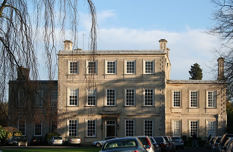
Photo: Wikimedia, CC BY-SA 3.0.
Harrowden Hall is a sports venue, which is situated 2 miles east of Hardwick STW.
Places in the Area
Nearby places include Hardwick and Great Harrowden.
Hardwick
Village
Hardwick is a small village in North Northamptonshire, England, close to the town of Wellingborough. The population is included in the civil parish of Great Harrowden. The village's name means "herd farm".
Great Harrowden
Village

Photo: M J Richardson, CC BY-SA 2.0.
Great Harrowden is a village and civil parish in North Northamptonshire, with a population at the 2011 census of 161. The village is located near the A509 road running between Kettering and Wellingborough. Great Harrowden is situated 1½ miles east of Hardwick STW.
Mears Ashby
Village
Mears Ashby is a village in the county of Northamptonshire, England. It lies between the county town of Northampton and Wellingborough and was in the West ward of borough council of Wellingborough area which also included Sywell prior to local government reform in 2021. Mears Ashby is situated 2½ miles southwest of Hardwick STW.
Hardwick STW
- Type: Wastewater treatment plant
- Category: industry
- Location: Hardwick, Wellingborough District, North Northamptonshire, England, United Kingdom, Britain and Ireland, Europe
- View on OpenStreetMap
Latitude
52.32178° or 52° 19′ 18″ northLongitude
-0.74974° or 0° 44′ 59″ westOperator
Anglian WaterOpen location code
9C4X87C2+P4OpenStreetMap ID
way 1395931253OpenStreetMap feature
man_made=wastewater_plant
This page is based on OpenStreetMap, Wikidata, and Wikimedia Commons.
We’d love your help improving our open data sources. Thank you for contributing.
Satellite Map
Discover Hardwick STW from above in high-definition satellite imagery.
Notable Places Nearby
Highlights include Church of St Leonard and Vivian’s Covert.
Nearby Places
Explore places such as Hardwick Grange and Plumbase.
England: Must-Visit Destinations
Delve into London, Manchester, Sheffield, and Leeds.
Curious Wastewater Treatment Plants to Discover
Uncover intriguing wastewater treatment plants from every corner of the globe.
About Mapcarta. Data © OpenStreetMap contributors and available under the Open Database License". Text is available under the CC BY-SA 4.0 license, except for photos, directions, and the map. Photo: sidibousaid, CC BY 2.0.