Liège Trilogiport - Port autonome de Liège
Liège Trilogiport - Port autonome de Liège is in Visé, Liège, Wallonia. Liège Trilogiport - Port autonome de Liège is situated nearby to the church Chapelle Sainte Vierge, as well as near the village Richelle.| Tap on a place to explore it |
Places of Interest Nearby
Highlights include Castle of Argenteau and Visé railway station.
Castle of Argenteau
Castle
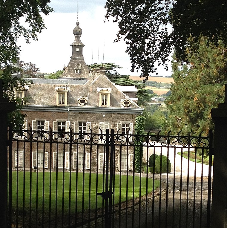
Photo: Hoebele, CC BY-SA 4.0.
Castle of Argenteau is situated 1½ km south of Liège Trilogiport - Port autonome de Liège.
Visé railway station
Railway station

Photo: Smiley.toerist, CC BY-SA 3.0.
Visé railway station is situated 2 km northeast of Liège Trilogiport - Port autonome de Liège.
Pont de Haccourt
Bridge

Photo: Les Meloures, CC BY-SA 3.0.
Pont de Haccourt is a bridge, which is situated 1¼ km north of Liège Trilogiport - Port autonome de Liège.
Places in the Area
Nearby places include Richelle and Argenteau.

Argenteau
Village

Photo: Flamenc, CC BY-SA 3.0.
Argenteau is a village, which is situated 3 km south of Liège Trilogiport - Port autonome de Liège.
Dalhem
Village

Photo: Flamenc, CC BY-SA 3.0.
Dalhem is a municipality of Wallonia located in the province of Liège, Belgium. On 1 January 2012 Dalhem had a total population of 6,996. The total area is 36.06 km² which gives a population density of 180 inhabitants per km². Dalhem is situated 3 km east of Liège Trilogiport - Port autonome de Liège.
Liège Trilogiport - Port autonome de Liège
Latitude
50.7236° or 50° 43′ 25″ northLongitude
5.68074° or 5° 40′ 51″ eastOpen location code
9F27PMFJ+C7OpenStreetMap ID
way 1427745092OpenStreetMap feature
landuse=industrialWikidata ID
Q3257376
This page is based on OpenStreetMap, Wikidata, and Wikimedia Commons.
We’d love your help improving our open data sources. Thank you for contributing.
Satellite Map
Discover Liège Trilogiport - Port autonome de Liège from above in high-definition satellite imagery.
In Other Languages
“Liège Trilogiport - Port autonome de Liège” goes by many names.
- French: “Liège Trilogiport”
Notable Places Nearby
Highlights include Chapelle Sainte Vierge and Clinique CHC Hermalle.
Nearby Places
Explore places such as D.L. Trilogiport and VDM Pâtisserie.
Curious Places to Discover
Uncover intriguing places from every corner of the globe.
About Mapcarta. Data © OpenStreetMap contributors and available under the Open Database License". Text is available under the CC BY-SA 4.0 license, except for photos, directions, and the map. Photo: M0tty, CC BY-SA 3.0.