SINC
SINC is a clinic in San Pedro Partido, Buenos Aires. SINC is situated nearby to the hospital Clinica Privada San Pedro, as well as near the library Biblioteca Popular Rafael Obligado.| Tap on a place to explore it |
Places of Interest Nearby
Highlights include USS Cahuilla and San Pedro train station.
USS Cahuilla
Museum

Photo: CHUCAO, CC BY-SA 3.0.
USS Cahuilla was an Abnaki class fleet tug in the service of the United States Navy during World War II. In 1961 she was sold to the Argentine Navy as ARA Irigoyen where she served until 2009 when she became a Museum ship. USS Cahuilla is situated 1 km north of SINC.
San Pedro train station
Railway station
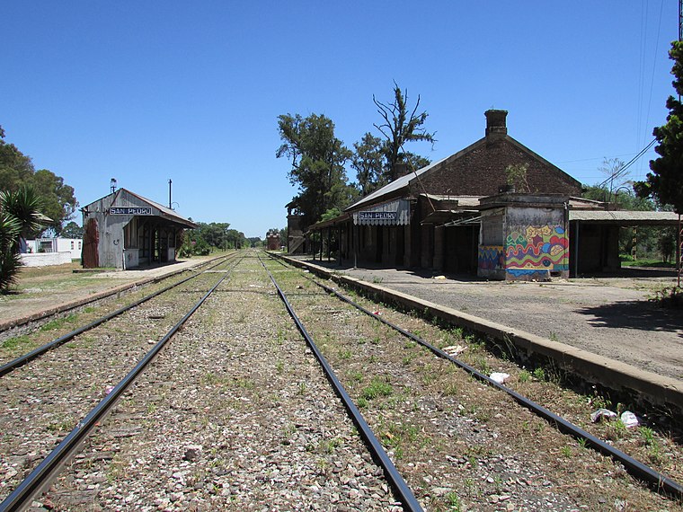
Photo: Alpertron, CC BY-SA 4.0.
San Pedro train station is a railway station, which is situated 2½ km southwest of SINC.
Places in the Area
Nearby places include San Pedro.
San Pedro
Town

Photo: Pablozeta, CC BY-SA 3.0.
San Pedro, full name Rincón de San Pedro Dávila de los Arrecifes, is a city and port in the Province of Buenos Aires, Argentina, beside the Paraná River.
SINC
- Type: Clinic
- Categories: health care and building
- Location: San Pedro Partido, Buenos Aires, Pampas, Argentina, South America
- View on OpenStreetMap
Latitude
-33.67676° or 33° 40′ 36″ southLongitude
-59.66585° or 59° 39′ 57″ westOpen location code
48R288FM+7MOpenStreetMap ID
way 1427967715OpenStreetMap feature
amenity=clinicOpenStreetMap feature
building=yesOpenStreetMap feature
healthcare=clinic
This page is based on OpenStreetMap, Wikidata, and Wikimedia Commons.
We’d love your help improving our open data sources. Thank you for contributing.
Satellite Map
Discover SINC from above in high-definition satellite imagery.
Notable Places Nearby
Highlights include Clinica Privada San Pedro and Biblioteca Popular Rafael Obligado.
Nearby Places
Explore places such as Viva! El Pollo and Tienda Sukucho.
Buenos Aires: Must-Visit Destinations
Delve into Buenos Aires, La Plata, Mar del Plata, and Centro.
Curious Clinics to Discover
Uncover intriguing clinics from every corner of the globe.
About Mapcarta. Data © OpenStreetMap contributors and available under the Open Database License". Text is available under the CC BY-SA 4.0 license, except for photos, directions, and the map. Photo: Mbusin, CC BY-SA 4.0.