Lottizzazione Piredda
Lottizzazione Piredda is a residential area in Province of Cagliari, Sardinia. Lottizzazione Piredda is situated nearby to the beach Perd’e Sali, as well as near Famar Vacanze.| Tap on a place to explore it |
Places of Interest Nearby
Highlights include Isola San Macario and Torre del Diavolo.
Isola San Macario
Islet

Photo: Discanto, CC BY-SA 3.0.
Isola San Macario is an islet, which is situated 3½ km south of Lottizzazione Piredda.
Torre del Diavolo
Tower

Photo: Rsroberto, CC BY-SA 4.0.
Torre del Diavolo is a tower, which is situated 1½ km northeast of Lottizzazione Piredda.
Chiesa di San Pietro
Church
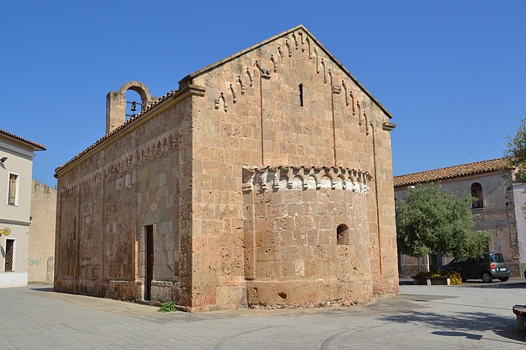 Chiesa di San Pietro is a church, which is situated 3 km west of Lottizzazione Piredda.
Places in the Area
Nearby places include Villa San Pietro and Pula.
Villa San Pietro
Village
Villa San Pietro is a comune in the Metropolitan City of Cagliari in the Italian region of Sardinia, located about 25 kilometres southwest of Cagliari. Villa San Pietro is situated 3 km west of Lottizzazione Piredda.
Pula
Village
 Pula is a comune in the Metropolitan City of Cagliari in the Italian region of Sardinia, located about 25 kilometres southwest of Cagliari. It has 7,090 inhabitants. Pula is situated 3½ km southwest of Lottizzazione Piredda.
Sarroch
Village

Photo: Giancarlodessi, CC BY-SA 3.0.
Sarroch is a comune in the Metropolitan City of Cagliari in the Italian region of Sardinia, located about 20 kilometres southwest of Cagliari. It has 4,970 inhabitants. Sarroch is situated 4 km north of Lottizzazione Piredda.
Lottizzazione Piredda
- Type: Residential area
- Location: Province of Cagliari, Sardinia, Italy, Europe
- View on OpenStreetMap
Latitude
39.03347° or 39° 2′ 1″ northLongitude
9.02762° or 9° 1′ 39″ eastOpen location code
8FFF22MH+92OpenStreetMap ID
way 1428996860OpenStreetMap feature
landuse=residential
This page is based on OpenStreetMap, Wikidata, and Wikimedia Commons.
We’d love your help improving our open data sources. Thank you for contributing.
Satellite Map
Discover Lottizzazione Piredda from above in high-definition satellite imagery.
Notable Places Nearby
Highlights include Perd’e Sali and Marina di Perd’e Sali.
Nearby Places
Explore places such as Perd`E Sali and Villa Margherita.
Sardinia: Must-Visit Destinations
Delve into Cagliari, Sassari, Alghero, and Nuoro.
Curious Residential Areas to Discover
Uncover intriguing residential areas from every corner of the globe.
About Mapcarta. Data © OpenStreetMap contributors and available under the Open Database License". Text is available under the CC BY-SA 4.0 license, except for photos, directions, and the map. Photo: Wikimedia, CC0.