Décanteurs
Décanteurs is an industrial building in Orly, Arrondissement of L’Haÿ-les-Roses, Île-de-France. Décanteurs is situated nearby to the pitch Stade de la Prairie, as well as near the sports venue Centre de Loisirs de la Prairie.| Tap on a place to explore it |
Places of Interest Nearby
Highlights include Les Saules and Pont ferroviaire de Choisy-le-Roi.
Les Saules
Railway station

Photo: Geralix, CC BY-SA 3.0.
Les Saules is a station in Paris's express suburban rail system, the RER. It serves the commune of Orly, in the Val-de-Marne department. Les Saules is situated 590 metres southwest of Décanteurs.
Pont ferroviaire de Choisy-le-Roi
Bridge
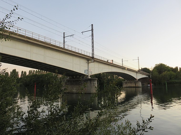
Photo: Akiry, CC BY-SA 4.0.
Pont ferroviaire de Choisy-le-Roi is a bridge, which is situated 460 metres north of Décanteurs.
Villeneuve-Triage station
Railway station

Photo: Wikimedia, CC BY-SA 3.0.
Villeneuve-Triage is a railway station in Villeneuve-Saint-Georges, Val-de-Marne, Paris, France. The station is on the Paris–Marseille railway. The station is served by Paris' express suburban rail system, the RER. The train services are operated by SNCF. Villeneuve-Triage station is situated 1 km east of Décanteurs.
Places in the Area
Nearby places include Orly and Villeneuve-le-Roi.
Orly
Town
Photo: Chabe01, CC BY-SA 4.0.
Orly is a commune in the southern suburbs of Paris, Île-de-France. It is located 12.7 km from the center of Paris. The name of Orly came from Latin Aureliacum, "the villa of Aurelius". Orly Airport partially lies on the territory of the commune of Orly, which gave its name to the airport.
Villeneuve-le-Roi
Town

Photo: besopha, CC BY-SA 2.0.
Villeneuve-le-Roi is a commune in the southern suburbs of Paris, France. It is located 13.7 km from the centre of Paris. The early 19th-century French orientalist Jean-Baptiste Rousseau was born in Villeneuve-le-Roi on the boat that arrived from Auxerre. Orly Airport is partially located in the commune.
Choisy-le-Roi
Town

Photo: 1quidam, CC BY-SA 3.0.
Choisy-le-Roi is a commune in the Val-de-Marne department, in the southeastern suburbs of Paris, Île-de-France.
Décanteurs
- Type: Industrial building
- Categories: building and industry
- Location: Orly, Arrondissement of L’Haÿ-les-Roses, Val-de-Marne, Île-de-France, France, Europe
- View on OpenStreetMap
Latitude
48.7485° or 48° 44′ 55″ northLongitude
2.42412° or 2° 25′ 27″ eastOpen location code
8FW4PCXF+9JOpenStreetMap ID
way 143322794OpenStreetMap feature
building=industrial
This page is based on OpenStreetMap, Wikidata, and Wikimedia Commons.
We’d love your help improving our open data sources. Thank you for contributing.
Satellite Map
Discover Décanteurs from above in high-definition satellite imagery.
Notable Places Nearby
Highlights include Stade de la Prairie and Centre de Loisirs de la Prairie.
Nearby Places
Explore places such as Batiment Ozone and Usine de production d’eau potable d’Orly.
Île-de-France: Must-Visit Destinations
Delve into Paris, Versailles, Boulogne-Billancourt, and Paris Charles de Gaulle Airport.
Curious Industrial Buildings to Discover
Uncover intriguing industrial buildings from every corner of the globe.
About Mapcarta. Data © OpenStreetMap contributors and available under the Open Database License". Text is available under the CC BY-SA 4.0 license, except for photos, directions, and the map. Photo: Guillaume Baviere, CC BY 2.0.