Rodney Stoke and Draycott Cemetery
Rodney Stoke and Draycott Cemetery is a cemetery in Rodney Stoke, Mendip District, England. Rodney Stoke and Draycott Cemetery is situated nearby to Springhead, as well as near the forest Stoke Woods.| Tap on a place to explore it |
Places of Interest Nearby
Highlights include Church of St Leonard, Rodney Stoke and Church of St Peter.
Church of St Leonard, Rodney Stoke
Church

Photo: Adrian and Janet Quantock, CC BY-SA 2.0.
The Church of St Leonard in Rodney Stoke, Somerset, England, was built around 1175 and is a Grade I listed building. The interior of the church contains a screen, bearing the date 1624, the gift of Sir Edward Rodney, which includes a representation of the martyrdom of St Erasmus, who was killed by having his entrails removed. Church of St Leonard, Rodney Stoke is situated 2,000 feet south of Rodney Stoke and Draycott Cemetery.
Church of St Peter
Church
St Peter's Church is an Anglican parish church in Draycott, Somerset, England. It dates from 1861. Designed by Charles Edmund Giles, the church is a Grade II listed building. Church of St Peter is situated 3,700 feet northwest of Rodney Stoke and Draycott Cemetery.
Cheddar Gorge
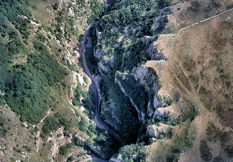
Photo: Arpingstone, Public domain.
Cheddar Gorge is a limestone gorge in the Mendip Hills, near the village of Cheddar, Somerset, England. The gorge is the site of the Cheddar show caves, where Great Britain's oldest complete human skeleton, Cheddar Man, estimated to be 9,000 years old, was found in 1903. Cheddar Gorge is situated 2½ miles northwest of Rodney Stoke and Draycott Cemetery.
Places in the Area
Nearby places include Rodney Stoke and Draycott.
Rodney Stoke
Village
Photo: Adrian and Janet Quantock, CC BY-SA 2.0.
Rodney Stoke is a small village and civil parish, located at grid reference ST486501, 5 miles north-west of Wells, in the English county of Somerset. The village is on the A371 between Draycott and Westbury-sub-Mendip.
Draycott
Village

Photo: Adrian and Janet Quantock, CC BY-SA 2.0.
Draycott is a village in Somerset, England, neighbouring the village of Cheddar on the southern edge of the Mendip Hills Area of Outstanding Natural Beauty. It is now the larger village in the civil parish of Rodney Stoke.
Westbury-sub-Mendip
Village

Photo: Rodw, Public domain.
Westbury-sub-Mendip is a village and civil parish in Somerset, England. The village is on the southern slopes of the Mendip Hills, 4 miles from Wells and Cheddar. The parish boundary is formed by the River Axe.
Rodney Stoke and Draycott Cemetery
- Type: Cemetery
- Category: burial
- Location: Rodney Stoke, Mendip District, Somerset, West Country, England, United Kingdom, Britain and Ireland, Europe
- View on OpenStreetMap
Latitude
51.25084° or 51° 15′ 3″ northLongitude
-2.74101° or 2° 44′ 28″ westOpen location code
9C3V7725+8HOpenStreetMap ID
way 1435370654OpenStreetMap feature
landuse=cemetery
This page is based on OpenStreetMap, Wikidata, and Wikimedia Commons.
We’d love your help improving our open data sources. Thank you for contributing.
Satellite Map
Discover Rodney Stoke and Draycott Cemetery from above in high-definition satellite imagery.
Notable Places Nearby
Highlights include Springhead and Stoke Woods.
Nearby Places
Explore places such as Rodney Stoke Garage and Rodney Stokes Inn.
Somerset: Must-Visit Destinations
Delve into Bristol, Bath, Wells, and Taunton.
Curious Cemeteries to Discover
Uncover intriguing cemeteries from every corner of the globe.
About Mapcarta. Data © OpenStreetMap contributors and available under the Open Database License". Text is available under the CC BY-SA 4.0 license, except for photos, directions, and the map. Photo: matthewhartley369, CC BY-SA 2.0.