Barf Bridge
Barf Bridge is a bridge in Bugthorpe, East Yorkshire, England. Barf Bridge is situated nearby to the forest Barf Plantation, as well as near the community center Bugthorpe Village Hall.| Tap on a place to explore it |
Places of Interest Nearby
Highlights include Church of St Andrew and Church of All Saints.
Church of St Andrew
Church

Photo: Roger Gilbertson, CC BY-SA 2.0.
Church of St Andrew is situated 1,700 feet northwest of Barf Bridge.
Church of All Saints
Church

Photo: Peter Church, CC BY-SA 2.0.
Church of All Saints is situated 2 miles east of Barf Bridge.
Painsthorpe Abbey
Residential area
Painsthorpe Abbey was a short-lived monastery of the Anglican Order of St. Benedict. It was established in 1902 at Painsthorpe in the East Riding of Yorkshire by Aelred Carlyle, a friend of Charles Chapman Grafton, Episcopal Bishop of Fond du Lac and an inspiration for Alfred Hope Patten. Painsthorpe Abbey is situated 2½ miles east of Barf Bridge.
Places in the Area
Nearby places include Garrowby and Youlthorpe.
Garrowby
Hamlet

Photo: Paul Allison, CC BY-SA 2.0.
Garrowby is a hamlet in the East Riding of Yorkshire, England. It is situated approximately 5 miles north of Pocklington town centre. It lies to the north of the A166 road and forms part of the civil parish of Kirby Underdale.
Youlthorpe
Hamlet

Photo: DS Pugh, CC BY-SA 2.0.
Youlthorpe is a hamlet in the East Riding of Yorkshire, England. It forms part of the civil parish of Bishop Wilton. It is situated approximately 10 miles east of York, 5 miles north-west of Pocklington and just south of the main A166 road from York to Bridlington.
Skirpenbeck
Village
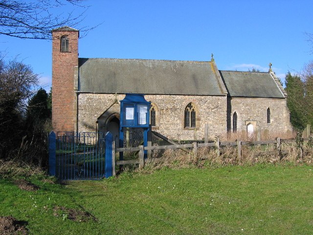
Photo: Stephen Horncastle, CC BY-SA 2.0.
Skirpenbeck is a village and civil parish in the East Riding of Yorkshire, England. It is situated 2 miles north-west of Stamford Bridge just north of the A166 road. Skirpenbeck is situated 2 miles west of Barf Bridge.
Barf Bridge
- Type: Bridge
- Category: transportation
- Location: Bugthorpe, East Yorkshire, Yorkshire, England, United Kingdom, Britain and Ireland, Europe
- View on OpenStreetMap
Latitude
54.00734° or 54° 0′ 26″ northLongitude
-0.81797° or 0° 49′ 5″ westOpen location code
9C6X254J+WROpenStreetMap ID
way 1436789339OpenStreetMap feature
man_made=bridge
This page is based on OpenStreetMap, Wikidata, and Wikimedia Commons.
We’d love your help improving our open data sources. Thank you for contributing.
Satellite Map
Discover Barf Bridge from above in high-definition satellite imagery.
Notable Places Nearby
Highlights include Barf Plantation and Bugthorpe Village Hall.
Nearby Places
Explore places such as Lilac Farm and Bugthorpe Bent Lane.
East Yorkshire: Must-Visit Destinations
Delve into Kingston upon Hull, Beverley, Bridlington, and Hornsea.
Curious Bridges to Discover
Uncover intriguing bridges from every corner of the globe.
About Mapcarta. Data © OpenStreetMap contributors and available under the Open Database License". Text is available under the CC BY-SA 4.0 license, except for photos, directions, and the map. Photo: AlasdairW, CC BY-SA 3.0.