Waters Bridge
Waters Bridge is a bridge in England, United Kingdom. Waters Bridge is situated nearby to the forest Bowsber Plantation, as well as near the motorhome stopover Orcaber Farm Camping.| Tap on a place to explore it |
Places of Interest Nearby
Highlights include Harden Bridge and Church of the Epiphany.
Harden Bridge
Bridge

Photo: Alexander P Kapp, CC BY-SA 2.0.
Harden Bridge is situated 3,200 feet east of Waters Bridge.
Church of the Epiphany
Church

Photo: James Bentall, CC BY-SA 2.0.
The Church of the Epiphany is the parish church of Austwick, a village in North Yorkshire, in England. The church was funded by Charles and E. A. Ingleby, and was constructed between 1839 and 1840. Church of the Epiphany is situated 1 mile northeast of Waters Bridge.
St James’ Church, Clapham
Church
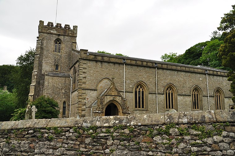
Photo: Nilfanion, CC BY-SA 4.0.
St James' Church is the parish church of Clapham, North Yorkshire, in England. The church was originally constructed in the 15th century. Other than the tower, it was rebuilt in 1814, and in 1899 a south porch was added and some of the windows were altered. St James’ Church, Clapham is situated 1¼ miles north of Waters Bridge.
Places in the Area
Nearby places include Clapham and Eldroth.
Clapham

Photo: RobThinks, CC BY-SA 4.0.
Clapham is a village in North Yorkshire, with a population of roughly 600. It's set in the limestone scenery of the Dales, and its main attractions are Ingleborough show cave and the cave complex of Gaping Gill.
Eldroth
Hamlet

Photo: Karl and Ali, CC BY-SA 2.0.
Eldroth is a village in North Yorkshire, England. It is in the civil parish of Lawkland, some 3.25 miles west of Settle, on a stream which is one of the tributaries of the River Wenning. Eldroth is situated 1½ miles southeast of Waters Bridge.
Keasden
Hamlet

Photo: Wikimedia, CC BY-SA 2.0.
Keasden is a hamlet in the civil parish of Clapham-cum-Newby, in the county of North Yorkshire, in the north-western England. It is about 2 miles to the south west of the village of Clapham and about 5 miles to the east of Bentham. Keasden is situated 2 miles southwest of Waters Bridge.
Waters Bridge
- Type: Bridge
- Category: transportation
- Location: England, United Kingdom, Britain and Ireland, Europe
- View on OpenStreetMap
Latitude
54.10448° or 54° 6′ 16″ northLongitude
-2.37974° or 2° 22′ 47″ westOpen location code
9C6V4J3C+Q4OpenStreetMap ID
way 1442164622OpenStreetMap feature
man_made=bridge
This page is based on OpenStreetMap, Wikidata, and Wikimedia Commons.
We’d love your help improving our open data sources. Thank you for contributing.
Satellite Map
Discover Waters Bridge from above in high-definition satellite imagery.
Places with the Same Name
Discover other places named “Waters Bridge”.
Notable Places Nearby
Highlights include Bowsber Plantation and Orcaber Farm Camping.
Nearby Places
Explore places such as Orcaber Farm and Bowsber.
England: Must-Visit Destinations
Delve into London, Manchester, Sheffield, and Leeds.
Curious Bridges to Discover
Uncover intriguing bridges from every corner of the globe.
About Mapcarta. Data © OpenStreetMap contributors and available under the Open Database License". Text is available under the CC BY-SA 4.0 license, except for photos, directions, and the map. Photo: sidibousaid, CC BY 2.0.