Sourbers Wood
Sourbers Wood is a forest in Eshton, Craven District, England. Sourbers Wood is situated nearby to the hamlet Eshton, as well as near Flasby.| Tap on a place to explore it |
Places of Interest
Highlights include Gargrave railway station and St Andrew’s Church, Gargrave.
Gargrave railway station
Railway station

Photo: Stephen Craven, CC BY-SA 2.0.
Gargrave is a railway station on the Bentham Line, which runs between Leeds and Morecambe via Skipton. The station, situated 30 miles north-west of Leeds, serves the village of Gargrave in North Yorkshire.
St Andrew’s Church, Gargrave
Church
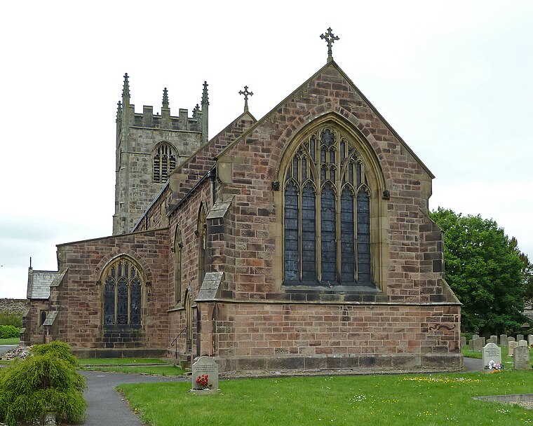 St Andrew's Church is the parish church of Gargrave, a village in North Yorkshire, in England. The church was probably originally built in the 16th century, from which period the tower survives.
Sharp Haw
Peak

Photo: Chris Heaton, CC BY-SA 2.0.
Sharp Haw is a hill on the southern edge of the Yorkshire Dales, located just within the National Park. Being the last outpost of the hills before the broad Aire valley, and with a sharp summit from many angles, it is prominent and easily recognisable from much of the area to the south.
Places in the Area
Nearby places include Coniston Cold and Hetton.
Coniston Cold
Village

Photo: Kate Jewell, CC BY-SA 2.0.
Coniston Cold is a village and civil parish in the county of North Yorkshire, England. The village lies 7 miles north-west of Skipton along the A65. It was historically part of the Staincliffe Wapentake of the West Riding of Yorkshire.
Hetton
Village

Photo: Wikimedia, CC BY-SA 2.0.
Hetton is a small Dales village in the civil parish of Hetton-cum-Bordley, in the county of North Yorkshire, England. It is situated 5.75 miles north of Skipton by the B6265 road.
Eshton
Hamlet
Eshton is a small village and civil parish in the county of North Yorkshire, England. At the 2011 Census the population was less than 100 and is included in the civil parish of Flasby with Winterburn.
Sourbers Wood
- Type: Forest
- Location: Eshton, Craven District, North Yorkshire, Yorkshire, England, United Kingdom, Britain and Ireland, Europe
- View on OpenStreetMap
Latitude
53.9995° or 53° 59′ 58″ northLongitude
-2.1028° or 2° 6′ 10″ westOpen location code
9C5VXVXW+RVOpenStreetMap ID
way 1446981926OpenStreetMap feature
natural=wood
This page is based on OpenStreetMap, Wikidata, and Wikimedia Commons.
We’d love your help improving our open data sources. Thank you for contributing.
Satellite Map
Discover Sourbers Wood from above in high-definition satellite imagery.
Localities in the Area
Explore places such as Flasby and Gargrave.
Notable Places Nearby
Highlights include New Close Plantation and Eshton Wood.
North Yorkshire: Must-Visit Destinations
Delve into York, Middlesbrough, Scarborough, and Ripon.
Curious Forests to Discover
Uncover intriguing forests from every corner of the globe.
About Mapcarta. Data © OpenStreetMap contributors and available under the Open Database License". Text is available under the CC BY-SA 4.0 license, except for photos, directions, and the map. Photo: Michael Bryan, CC BY 2.0.