St John the Baptist Churchyard Extension
St John the Baptist Churchyard Extension is a cemetery in Kirkby Wharfe with North Milford, Selby District, England. St John the Baptist Churchyard Extension is situated nearby to the forest Ladyflats Belt, as well as near the hamlet Kirkby Wharfe.| Tap on a place to explore it |
Places of Interest Nearby
Highlights include St John the Baptist’s Church, Kirkby Wharfe and Ulleskelf railway station.
St John the Baptist’s Church, Kirkby Wharfe
Church

Photo: Paul Glazzard, CC BY-SA 2.0.
St John the Baptist's Church is the parish church of Kirkby Wharfe, a village south-west of Tadcaster, in North Yorkshire, in England. The church was first built in the late 12th century, with the nave and parts of the south door surviving from this period. St John the Baptist’s Church, Kirkby Wharfe is situated 1,200 feet north of St John the Baptist Churchyard Extension.
Ulleskelf railway station
Railway station

Photo: Dupont Circle, Public domain.
Ulleskelf railway station in Ulleskelf, North Yorkshire, England, is 8.75 miles south of York. Ulleskelf railway station is situated 1 mile southeast of St John the Baptist Churchyard Extension.
Grimston Park
Building
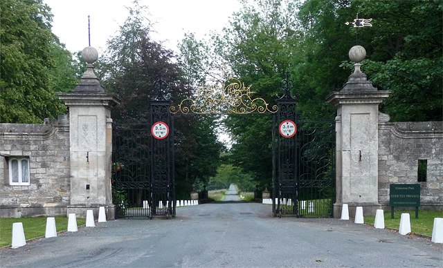
Photo: Wikimedia, CC BY-SA 2.0.
Grimston Park is a grade II* listed Georgian country house in Grimston, North Yorkshire, England, some 1.7 miles south of Tadcaster. Since being owned by the Fielden family, it has been converted into a number of luxury homes. Grimston Park is situated 2,800 feet northwest of St John the Baptist Churchyard Extension.
Places in the Area
Nearby places include Kirkby Wharfe and Ulleskelf.
Kirkby Wharfe
Hamlet
Photo: Paul Glazzard, CC BY-SA 2.0.
Kirkby Wharfe is a village 1.9 miles south of Tadcaster, in North Yorkshire, England. The village is in the civil parish of Kirkby Wharfe with North Milford.
Ulleskelf
Village

Photo: Robert Neilson, CC BY-SA 2.0.
Ulleskelf is a village and civil parish in the county of North Yorkshire, England, four miles from Tadcaster on the River Wharfe. Its name comes from the Scandinavian personal name Úlfr, while skelf may be an Old English word meaning "a flat area", although it could be from the Old Scandinavian equivalent, 'skialf' as in several other English place names, e.g. Hunshelf, Wadshelf.
Bolton Percy
Village

Photo: Wikimedia, CC BY-SA 2.0.
Bolton Percy is a village and civil parish in the county of North Yorkshire, England. According to the 2001 census it had a population of 305 in 115 households, reducing marginally to 304 at the 2011 census. Bolton Percy is situated 1½ miles east of St John the Baptist Churchyard Extension.
St John the Baptist Churchyard Extension
- Type: Cemetery
- Category: burial
- Location: Kirkby Wharfe with North Milford, Selby District, North Yorkshire, Yorkshire, England, United Kingdom, Britain and Ireland, Europe
- View on OpenStreetMap
Latitude
53.86022° or 53° 51′ 37″ northLongitude
-1.23266° or 1° 13′ 58″ westOpen location code
9C5WVQ68+3WOpenStreetMap ID
way 1447086016OpenStreetMap feature
landuse=cemetery
This page is based on OpenStreetMap, Wikidata, and Wikimedia Commons.
We’d love your help improving our open data sources. Thank you for contributing.
Satellite Map
Discover St John the Baptist Churchyard Extension from above in high-definition satellite imagery.
Notable Places Nearby
Highlights include Ladyflats Belt and Crow Wood.
Nearby Places
Explore places such as Home Farm and The Croft.
North Yorkshire: Must-Visit Destinations
Delve into York, Middlesbrough, Scarborough, and Ripon.
Curious Cemeteries to Discover
Uncover intriguing cemeteries from every corner of the globe.
About Mapcarta. Data © OpenStreetMap contributors and available under the Open Database License". Text is available under the CC BY-SA 4.0 license, except for photos, directions, and the map. Photo: Michael Bryan, CC BY 2.0.