Bosenheimer Hof
Bosenheimer Hof is a farm in Bad Kreuznach, Naheland, Rhineland-Palatinate. Bosenheimer Hof is situated nearby to the pitch Bolzplatz, as well as near the fire station Freiwillige Feuerwehr Bad Kreuznach Löschbezirk Ost.| Tap on a place to explore it |
Places of Interest Nearby
Highlights include Evangelische Kirche and St. Gordianus (Planig).
Evangelische Kirche
Church

Photo: Nahefoto, Public domain.
Evangelische Kirche is a church, which is situated 760 metres south of Bosenheimer Hof.
St. Gordianus (Planig)
Church
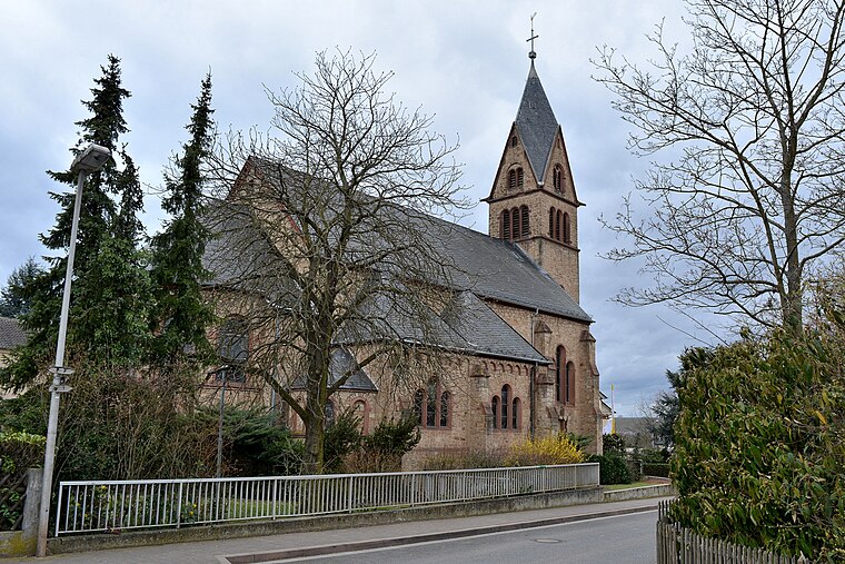
Photo: RomkeHoekstra, CC BY-SA 4.0.
St. Gordianus (Planig) is a church, which is situated 1¼ km north of Bosenheimer Hof.
Auferstehungskirche
Church

Photo: RomkeHoekstra, CC BY-SA 4.0.
Auferstehungskirche is a church, which is situated 1¼ km north of Bosenheimer Hof.
Places in the Area
Nearby places include Bosenheim and Pfaffen-Schwabenheim.

Pfaffen-Schwabenheim
Village

Photo: Nahefoto, Public domain.
Pfaffen-Schwabenheim is an Ortsgemeinde – a municipality belonging to a Verbandsgemeinde, a kind of collective municipality – in the Bad Kreuznach district in Rhineland-Palatinate, Germany. Pfaffen-Schwabenheim is situated 2½ km east of Bosenheimer Hof.
Biebelsheim
Village

Photo: Wikimedia, Public domain.
Biebelsheim is an Ortsgemeinde – a municipality belonging to a Verbandsgemeinde, a kind of collective municipality – in the Bad Kreuznach district in Rhineland-Palatinate, Germany. Biebelsheim is situated 3 km northeast of Bosenheimer Hof.
Bosenheimer Hof
- Type: Farm
- Category: agriculture
- Location: Bad Kreuznach, Bad Kreuznach, Naheland, Rhineland-Palatinate, Germany, Central Europe, Europe
- View on OpenStreetMap
Latitude
49.8513° or 49° 51′ 5″ northLongitude
7.91502° or 7° 54′ 54″ eastOpen location code
8FX9VW28+G2OpenStreetMap ID
way 144731014OpenStreetMap feature
landuse=farmyard
This page is based on OpenStreetMap, Wikidata, and Wikimedia Commons.
We’d love your help improving our open data sources. Thank you for contributing.
Satellite Map
Discover Bosenheimer Hof from above in high-definition satellite imagery.
Notable Places Nearby
Highlights include Bolzplatz and Freiwillige Feuerwehr Bad Kreuznach Löschbezirk Ost.
Nearby Places
Explore places such as Haas & Aubel and Landissimo.
Curious Farms to Discover
Uncover intriguing farms from every corner of the globe.
About Mapcarta. Data © OpenStreetMap contributors and available under the Open Database License". Text is available under the CC BY-SA 4.0 license, except for photos, directions, and the map. Photo: giggel, CC BY 3.0.