Gwern y Cegyrn
Gwern y Cegyrn is a forest in St Fagans, Cardiff, Wales. Gwern y Cegyrn is situated nearby to the neighborhood Rhydlafar, as well as near Parc Plymouth.| Tap on a place to explore it |
Places of Interest
Highlights include St Fagans National Museum of History and Radyr railway station.
St Fagans National Museum of History
Park
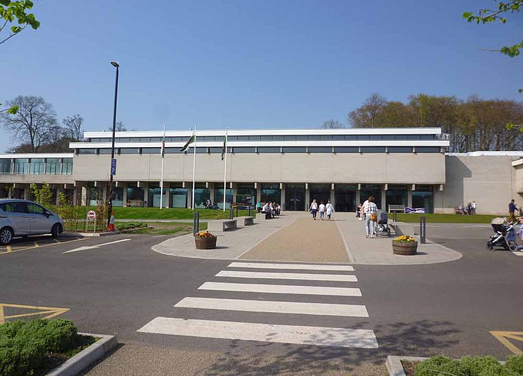
Photo: Sionk, CC BY-SA 4.0.
St Fagans National Museum of History, commonly referred to as St Fagans after the village where it is located, is an open-air museum in St Fagans, Cardiff, Wales, chronicling the historical lifestyle, culture, and architecture of the Welsh people.
Radyr railway station
Railway station

Photo: Wikimedia, CC BY-SA 2.0.
Radyr railway station is a railway station serving the Radyr area of Cardiff, South Wales. It is at the foot of the hill at the eastern edge of the village, alongside the River Taff and adjacent to the Taff Trail.
St Teilo’s Church
Museum

Photo: Adrian Platt, CC BY-SA 2.0.
St Teilo's Church is a historic building originally located at Llandeilo Tal-y-Bont near Pontarddulais and now reconstructed at St Fagans National History Museum in Cardiff, Wales.
Places in the Area
Nearby places include Ely and Caerau.
Ely
Suburb

Photo: Tony Hodge, CC BY-SA 2.0.
Ely is a district and community in Cardiff, Wales. It is to the north of Cowbridge Road West. Caerau defines the boundary to the south as does the River Ely to the east and in part to the north.
Caerau
Suburb

Photo: Welshleprechaun, Public domain.
Caerau is a community in the west of Cardiff, capital city of Wales. Often considered part of Wenvoe by gully, Heol Trelai is the main road or avenue, lined with large trees.
Creigiau
Suburb

Photo: Colin Pyle, CC BY-SA 2.0.
Creigiau is a dormitory settlement in the north-west of Cardiff, the capital of Wales. The village currently has about 1,500 houses and a population of approximately 5,000 people.
Gwern y Cegyrn
- Type: Forest
- Location: St Fagans, Cardiff, Wales, United Kingdom, Britain and Ireland, Europe
- View on OpenStreetMap
Latitude
51.5126° or 51° 30′ 46″ northLongitude
-3.2755° or 3° 16′ 32″ westOpen location code
9C3RGP7F+3QOpenStreetMap ID
way 1448158572OpenStreetMap feature
natural=wood
This page is based on OpenStreetMap, Wikidata, and Wikimedia Commons.
We’d love your help improving our open data sources. Thank you for contributing.
Satellite Map
Discover Gwern y Cegyrn from above in high-definition satellite imagery.
Localities in the Area
Explore places such as Rhydlafar and Parc Plymouth.
Notable Places Nearby
Highlights include Coed y Trenches and Maerdy Wood.
Wales: Must-Visit Destinations
Delve into Swansea, Llanfairpwllgwyngyll, Newport, and Bangor.
Curious Forests to Discover
Uncover intriguing forests from every corner of the globe.
About Mapcarta. Data © OpenStreetMap contributors and available under the Open Database License". Text is available under the CC BY-SA 4.0 license, except for photos, directions, and the map. Photo: Gordon Plant, CC BY 2.0.