Clearline Desilting
Clearline Desilting is a shop in Bottesford, North Lincolnshire, England which is located on Grange Lane South. Clearline Desilting is situated nearby to Bottesford Baptist Church, as well as near Frederick Gough School.| Tap on a place to explore it |
Places of Interest Nearby
Highlights include Frederick Gough School and Ashby Library and Local Link.
Frederick Gough School
School
Frederick Gough School is a community secondary school in Scunthorpe, England, for approximately 1,300 pupils aged from 11 to 16. Frederick Gough School is situated 1,300 feet southeast of Clearline Desilting.
Ashby Library and Local Link
Community center
 Ashby Library and Local Link is a community center, which is situated 2,900 feet northwest of Clearline Desilting.
St Peter’s Church
Church

Photo: Richard Croft, CC BY-SA 2.0.
St Peter’s Church is situated 3,000 feet south of Clearline Desilting.
Places in the Area
Nearby places include Ashby and Bottesford.
Ashby
Suburb
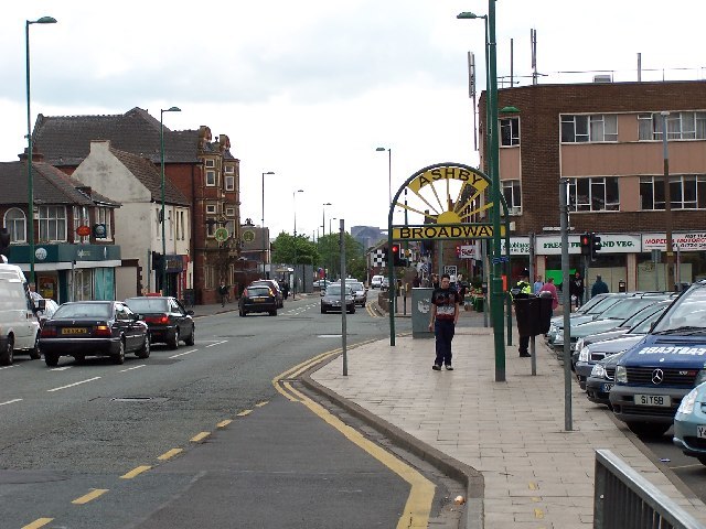
Photo: Steve Parker, CC BY-SA 2.0.
Ashby is a suburb of Scunthorpe, in the North Lincolnshire district, in the ceremonial county of Lincolnshire, England.
Bottesford
Suburb
Photo: Richard Croft, CC BY-SA 2.0.
Bottesford is a town in North Lincolnshire, Lincolnshire, England. Historically a village, Bottesford forms a contiguous urban area of Scunthorpe. In the 2001 Census, Bottesford's population was recorded as 11,171, falling to 11,038 at the 2011 census.
Holme
Hamlet

Photo: Jonathan Billinger, CC BY-SA 2.0.
Holme is a linear settlement and former civil parish, now in the parish of Messingham, in the North Lincolnshire district, in the ceremonial county of Lincolnshire, England. Holme is situated 1½ miles east of Clearline Desilting.
Clearline Desilting
- Type: Shop
- Address: 257 Grange Lane South, Scunthorpe, DN16 3NJ
- Category: building
- Location: Bottesford, North Lincolnshire, England, United Kingdom, Britain and Ireland, Europe
- View on OpenStreetMap
Latitude
53.5603° or 53° 33′ 37″ northLongitude
-0.64499° or 0° 38′ 42″ westOperator
Clearline DesiltingOpen location code
9C5XH964+42OpenStreetMap ID
way 1449275059OpenStreetMap feature
building=yesOpenStreetMap feature
shop=repair
This page is based on OpenStreetMap, Wikidata, and Wikimedia Commons.
We’d love your help improving our open data sources. Thank you for contributing.
Satellite Map
Discover Clearline Desilting from above in high-definition satellite imagery.
Notable Places Nearby
Highlights include Bottesford Baptist Church and Spider Park.
Nearby Places
Explore places such as Grange Lane South and Garage.
England: Must-Visit Destinations
Delve into London, Manchester, Sheffield, and Leeds.
Curious Shops to Discover
Uncover intriguing shops from every corner of the globe.
About Mapcarta. Data © OpenStreetMap contributors and available under the Open Database License". Text is available under the CC BY-SA 4.0 license, except for photos, directions, and the map. Photo: sidibousaid, CC BY 2.0.