Cash’s Park Play Area
Cash’s Park Play Area is a playground in Coventry, England. Cash’s Park Play Area is situated nearby to the forest Cash’s Spinney, as well as near Coventry University - Foleshill Studios.| Tap on a place to explore it |
Places of Interest Nearby
Highlights include Coventry Cathedral and Coventry Transport Museum.
Coventry Cathedral
Church
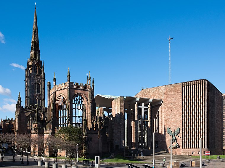
Photo: DeFacto, CC BY-SA 4.0.
The Cathedral Church of Saint Michael, commonly known as Coventry Cathedral, is the seat of the Bishop of Coventry and the Diocese of Coventry within the Church of England. Coventry Cathedral is situated 1 mile south of Cash’s Park Play Area.
Coventry Transport Museum
Museum

Photo: Jim Linwood, CC BY 2.0.
Coventry Transport Museum is a transport museum, located in Coventry city centre, England. It houses the largest collection of British-made road transport held in public ownership. Coventry Transport Museum is situated 4,000 feet south of Cash’s Park Play Area.
Herbert Art Gallery and Museum
Museum

Photo: E Gammie, CC BY-SA 2.0.
Herbert Art Gallery & Museum is a museum, art gallery, records archive, learning centre, media studio and creative arts facility on Jordan Well, Coventry, England. Herbert Art Gallery and Museum is situated 1 mile south of Cash’s Park Play Area.
Places in the Area
Nearby places include Bishopgate Green and Radford.
Bishopgate Green
Neighborhood

Photo: Stephen McKay, CC BY-SA 2.0.
Bishopgate Green is a suburb of Coventry in the West Midlands, England. It is located on the Coventry Canal. It is an area between Foleshill and Hillfields and shares the area code CV1.
Radford
Suburb

Photo: Niki Walton, CC BY-SA 2.0.
Radford is a suburb and electoral ward of Coventry, located approximately 1.5 miles north of Coventry city centre. It is covered by the Coventry North West constituency.
Hillfields
Suburb
Hillfields is a suburb of Coventry in the West Midlands of England. It is situated north of Coventry city centre, and has undergone a series of name changes throughout its history originally called "Harnall" and has seen itself change from a village, to a remote suburb, to a large postwar redevelopment zone.
Cash’s Park Play Area
- Type: Playground
- Category: recreation area
- Location: Coventry, England, United Kingdom, Britain and Ireland, Europe
- View on OpenStreetMap
Latitude
52.4222° or 52° 25′ 20″ northLongitude
-1.51032° or 1° 30′ 37″ westOpen location code
9C4WCFCQ+VVOpenStreetMap ID
way 1455158614OpenStreetMap feature
leisure=playground
This page is based on OpenStreetMap, Wikidata, and Wikimedia Commons.
We’d love your help improving our open data sources. Thank you for contributing.
Satellite Map
Discover Cash’s Park Play Area from above in high-definition satellite imagery.
Notable Places Nearby
Highlights include Cash’s Park and Cash’s Spinney.
Nearby Places
Explore places such as Cash’s Topshops and Screwfix.
England: Must-Visit Destinations
Delve into London, Manchester, Sheffield, and Leeds.
Curious Playgrounds to Discover
Uncover intriguing playgrounds from every corner of the globe.
About Mapcarta. Data © OpenStreetMap contributors and available under the Open Database License". Text is available under the CC BY-SA 4.0 license, except for photos, directions, and the map. Photo: Mintchocicecream, CC0.