Arbaugh - Dunlap Cemetery
Arbaugh - Dunlap Cemetery is a cemetery in Siskiyou County, Shasta Cascades, California.| Tap on a place to explore it |
Places in the Area
Nearby places include Weed.
Weed
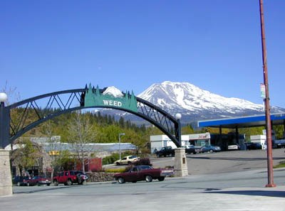
Photo: Marshman, CC BY-SA 3.0.
Weed is a city of 2,700 people in Siskiyou County in the Shasta Cascades region of California, at the western foot of Mount Shasta.
Arbaugh - Dunlap Cemetery
- Type: Cemetery
- Category: burial
- Location: Siskiyou County, Shasta Cascades, California, United States, North America
- View on OpenStreetMap
Latitude
41.49128° or 41° 29′ 29″ northLongitude
-122.40787° or 122° 24′ 28″ westOpen location code
84HVFHRR+GVOpenStreetMap ID
way 1455953625OpenStreetMap feature
landuse=cemetery
This page is based on OpenStreetMap, Wikidata, and Wikimedia Commons.
We’d love your help improving our open data sources. Thank you for contributing.
Satellite Map
Discover Arbaugh - Dunlap Cemetery from above in high-definition satellite imagery.
Notable Places Nearby
Highlights include Edgewood Post Office and Weed Airport.
Nearby Places
Explore places such as Country Club and Butteville Union Elementary School.
Siskiyou County: Must-Visit Destinations
Delve into Yreka, Weed, Dorris, and Mount Shasta.
Curious Cemeteries to Discover
Uncover intriguing cemeteries from every corner of the globe.
About Mapcarta. Data © OpenStreetMap contributors and available under the Open Database License". Text is available under the CC BY-SA 4.0 license, except for photos, directions, and the map. Photo: Wikimedia, CC0.