The Marlstone Tavern
The Marlstone Tavern is a building in Milton, Cherwell, England which is located on Milton. The Marlstone Tavern is situated nearby to Church of St John the Evangelist, as well as near the hamlet Milton.| Tap on a place to explore it |
Places of Interest Nearby
Highlights include Church of St John the Evangelist and Bloxham Village Museum.

Bloxham Village Museum
Museum

Photo: David Stowell, CC BY-SA 2.0.
Bloxham Village Museum is a local museum located in the village of Bloxham in Oxfordshire, England. It was established in 1980 and is in the old court house and fire station in a corner of St Mary's churchyard. Bloxham Village Museum is situated 1¼ miles west of The Marlstone Tavern.
Adderbury Library
Library
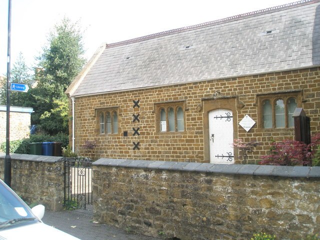
Photo: Basher Eyre, CC BY-SA 2.0.
Adderbury Library is situated 1¼ miles east of The Marlstone Tavern.
Places in the Area
Nearby places include Milton and Barford St John.
Milton
Hamlet

Photo: David Stowell, CC BY-SA 2.0.
Milton is a village and civil parish about 2.5 miles south of Banbury in Oxfordshire, on the Milton road between the villages of Adderbury and Bloxham.
Barford St John
Hamlet

Photo: Ben Nicholson, CC BY-SA 2.0.
Barford St John is a small village in the civil parish of Barford St John and St Michael, in the Cherwell district of Oxfordshire, England. It is on the north bank of the River Swere, about 5 miles south of Banbury.
Adderbury
Village

Photo: Alan Ford, CC BY-SA 2.0.
Adderbury is a winding linear village and rural civil parish about 3 miles south of Banbury in northern Oxfordshire, England. The settlement has five sections: the new Milton Road housing Development and West Adderbury, towards the southwest; East Adderbury…
The Marlstone Tavern
- Type: Building
- Address: Milton, Banbury, OX15 4HH
- Location: Milton, Cherwell, Oxfordshire, South East England, England, United Kingdom, Britain and Ireland, Europe
- View on OpenStreetMap
Latitude
52.01178° or 52° 0′ 42″ northLongitude
-1.34467° or 1° 20′ 41″ westOpen location code
9C4W2M64+P4OpenStreetMap ID
way 1457127813OpenStreetMap feature
building=yes
This page is based on OpenStreetMap, Wikidata, and Wikimedia Commons.
We’d love your help improving our open data sources. Thank you for contributing.
Satellite Map
Discover The Marlstone Tavern from above in high-definition satellite imagery.
Notable Places Nearby
Highlights include Waillin Road Play Area and Adderbury Cemetery.
Nearby Places
Explore places such as The Black Boy and Black Boy Inn.
Oxfordshire: Must-Visit Destinations
Delve into Oxford, Abingdon-on-Thames, Banbury, and Woodstock.
Curious Buildings to Discover
Uncover intriguing buildings from every corner of the globe.
About Mapcarta. Data © OpenStreetMap contributors and available under the Open Database License". Text is available under the CC BY-SA 4.0 license, except for photos, directions, and the map. Photo: Wikimedia, CC0.