Shoes 4 Less
Shoes 4 Less is a shoe store in Los Angeles, Southern California, California. Shoes 4 Less is situated nearby to the marketplace Del Amo Swap Meet, as well as near the bus station Del Amo Station.| Tap on a place to explore it |
Places of Interest Nearby
Highlights include Del Amo station and Artesia station.
Del Amo station
Railway station

Photo: HanSangYoon, CC BY-SA 4.0.
Del Amo station is an elevated light rail station on the A Line of the Los Angeles Metro Rail system. The station is located between Compton Creek and Santa Fe Avenue, and elevated over the intersection of Del Amo Boulevard, after which the station is named, in the Los Angeles County community of Rancho Dominguez and near the city of Carson. Del Amo station is situated 510 feet northeast of Shoes 4 Less.
Artesia station
Railway station
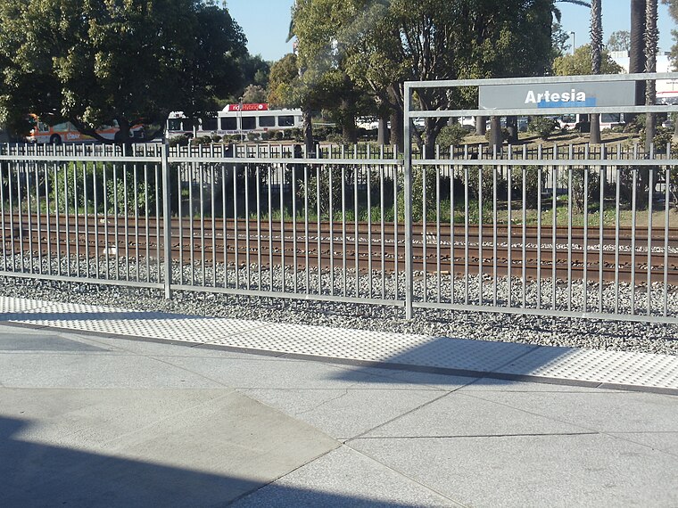
Photo: METRO96, CC BY-SA 3.0.
Artesia station is an at-grade light rail station on the A Line of the Los Angeles Metro Rail system. The station is located alongside the Union Pacific freight railroad's Wilmington Subdivision, at its intersection with Artesia Boulevard, after which the station is named, in the city of Compton, California. Artesia station is situated 2 miles north of Shoes 4 Less.
Wardlow station
Railway station

Photo: Lars Smiley, Public domain.
Wardlow station is an at-grade light rail station on the A Line of the Los Angeles Metro Rail system. The station is located on the A Line's exclusive right-of-way that parallels Pacific Place, at its intersection with Wardlow Street, after which the station is named, in the Wrigley neighborhood of Long Beach, California. Wardlow station is situated 2 miles southeast of Shoes 4 Less.
Places in the Area
Nearby places include Rancho Dominguez and North Long Beach.
Rancho Dominguez
Suburb
Rancho Dominguez is an unincorporated community in Los Angeles County, California, United States. Rancho Dominguez is located between the cities of Compton, Long Beach and Carson.
North Long Beach
Suburb

Photo: Darkest tree, CC BY-SA 4.0.
North Long Beach is a predominantly working-class area of Long Beach, California. The neighborhood is bounded to the west, north and east by the Long Beach city limits, and to the south by a Union Pacific railroad track and the Bixby Knolls neighborhood. North Long Beach is situated 2 miles northeast of Shoes 4 Less.
Bixby Knolls
Suburb
Bixby Knolls is a neighborhood in Long Beach, California, named after the Bixby family. Bixby Knolls is situated 2 miles east of Shoes 4 Less.
Shoes 4 Less
- Type: Shoe store
- Category: shop
- Location: Los Angeles, Southern California, California, United States, North America
- View on OpenStreetMap
Latitude
33.84718° or 33° 50′ 50″ northLongitude
-118.21234° or 118° 12′ 44″ westOpen location code
8553RQWQ+V3OpenStreetMap ID
way 1459439840OpenStreetMap feature
shop=shoes
This page is based on OpenStreetMap, Wikidata, and Wikimedia Commons.
We’d love your help improving our open data sources. Thank you for contributing.
Satellite Map
Discover Shoes 4 Less from above in high-definition satellite imagery.
Notable Places Nearby
Highlights include Del Amo Swap Meet and Del Amo Station.
Nearby Places
Explore places such as Alexia Beauty Salon and Del Amo Station (Discharge) (Metro 202 Northbound & Southbound).
Los Angeles: Must-Visit Destinations
Delve into Hollywood, San Gabriel Valley, San Fernando Valley, and Long Beach.
Curious Shoe Stores to Discover
Uncover intriguing shoe stores from every corner of the globe.
About Mapcarta. Data © OpenStreetMap contributors and available under the Open Database License". Text is available under the CC BY-SA 4.0 license, except for photos, directions, and the map. Photo: Mfield, CC BY-SA 3.0.