Fährmannssand
Fährmannssand is a farm in Wedel, Pinneberg, Schleswig-Holstein. Fährmannssand is situated nearby to the tourism office NABU-Vogelstation Wedel, as well as near the village Hetlingen.| Tap on a place to explore it |
Places of Interest Nearby
Highlights include Hatzburg and Mielstack Unterfeuer.

Mielstack Unterfeuer
Lighthouse

Photo: Ajepbah, CC BY-SA 3.0 de.
Mielstack Unterfeuer is a lighthouse, which is situated 2 km southwest of Fährmannssand.
Theaterschiff Batavia
Theater building
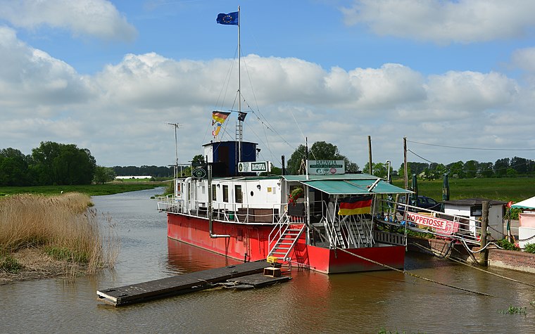 Theaterschiff Batavia is a theater building, which is situated 2½ km east of Fährmannssand.
Places in the Area
Nearby places include Hetlingen and Grünendeich.
Hetlingen
Village

Photo: Wikimedia, CC BY-SA 3.0.
Hetlingen is a municipality in the district of Pinneberg in the German state of Schleswig-Holstein. Hetlingen is the site of Elbe Crossing 1 and Elbe Crossing 2, two power line crossings across the river Elbe. Hetlingen is situated 3 km northwest of Fährmannssand.
Grünendeich
Village

Photo: flamenc, CC BY-SA 3.0.
Grünendeich is a municipality in the district of Stade, Lower Saxony, Germany. It belonged to the Prince-Archbishopric of Bremen. In 1648 the Prince-Archbishopric was transformed into the Duchy of Bremen, which was first ruled in personal union by the Swedish and from 1715 on by the Hanoverian Crown. Grünendeich is situated 3½ km west of Fährmannssand.
Holm
Village
 Holm is a municipality in the district of Pinneberg, in Schleswig-Holstein, Germany. It is part of the Amt Geest und Marsch Südholstein. In the eastern part is the local recreation area Holmer Sandberge, to the west of Holm begins the Elbmarsch. Holm is situated 4 km north of Fährmannssand.
Fährmannssand
- Type: Farm
- Category: agriculture
- Location: Wedel, Pinneberg, South Holstein, Schleswig-Holstein, Germany, Central Europe, Europe
- View on OpenStreetMap
Latitude
53.58467° or 53° 35′ 5″ northLongitude
9.659° or 9° 39′ 32″ eastOpen location code
9F5FHMM5+VJOpenStreetMap ID
way 146454632OpenStreetMap feature
landuse=farmyard
This page is based on OpenStreetMap, Wikidata, and Wikimedia Commons.
We’d love your help improving our open data sources. Thank you for contributing.
Satellite Map
Discover Fährmannssand from above in high-definition satellite imagery.
Notable Places Nearby
Highlights include NABU-Vogelstation Wedel and Wedeler Marsch.
Nearby Places
Explore places such as Landgaststätte Fährmannssand and Planetenlehrpfad: Uranus.
South Holstein: Must-Visit Destinations
Delve into Neumünster, Itzehoe, Glückstadt, and Bad Segeberg.
Curious Farms to Discover
Uncover intriguing farms from every corner of the globe.
About Mapcarta. Data © OpenStreetMap contributors and available under the Open Database License". Text is available under the CC BY-SA 4.0 license, except for photos, directions, and the map. Photo: HP-WEDEL, CC BY-SA 4.0.