GSF
GSF is a building in Itzehoe, Steinburg, Schleswig-Holstein which is located on Ottensstraße. GSF is situated nearby to the community center Begegnungsstätte, Kinder und Jugendtreff Wellenkamp, as well as near the sports venue Sporthalle Wellenkamp.| Tap on a place to explore it |
Places of Interest Nearby
Highlights include Wenzel-Hablik-Museum and Itzehoe station.
Wenzel-Hablik-Museum
Museum

Photo: Wikimedia, CC BY-SA 3.0.
Wenzel-Hablik-Museum is situated 2½ km northeast of GSF.
Itzehoe station
Railway station
 Itzehoe station is a railway station in the town of Itzehoe in the German state of Schleswig-Holstein. It is located on the Marsh Railway, which is electrified from Elmshorn up to this point. It is classified by Deutsche Bahn as a category 3 station. Itzehoe station is situated 3 km northeast of GSF.
Prinzesshof
Museum
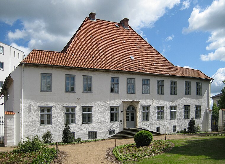
Photo: Nightflyer, CC BY 3.0.
Prinzesshof is a museum, which is situated 3 km northeast of GSF.
Places in the Area
Nearby places include Münsterdorf and Lägerdorf.
Münsterdorf
Village
 Münsterdorf is a municipality in the district of Steinburg, in Schleswig-Holstein, Germany. Münsterdorf is situated 3 km east of GSF.
Lägerdorf
Village
 Lägerdorf is a municipality in the district of Steinburg, in Schleswig-Holstein, Germany. Lägerdorf is situated 6 km east of GSF.
Krempe
Village

Photo: PodracerHH, CC BY-SA 3.0.
Krempe is a town in the district of Steinburg, in Schleswig-Holstein, Germany. It is situated between Itzehoe and Glückstadt. Krempe is part of the Amt Krempermarsch. Krempe is situated 7 km south of GSF.
GSF
- Type: Building
- Address: Ottensstraße 2A, Itzehoe, 25524
- Location: Itzehoe, Steinburg, South Holstein, Schleswig-Holstein, Germany, Central Europe, Europe
- View on OpenStreetMap
Latitude
53.90314° or 53° 54′ 11″ northLongitude
9.48805° or 9° 29′ 17″ eastOpen location code
9F5FWF3Q+76OpenStreetMap ID
way 153230168OpenStreetMap feature
building=yes
This page is based on OpenStreetMap, Wikidata, and Wikimedia Commons.
We’d love your help improving our open data sources. Thank you for contributing.
Satellite Map
Discover GSF from above in high-definition satellite imagery.
Places with the Same Name
Discover other places named “GSF”.
Notable Places Nearby
Highlights include Begegnungsstätte, Kinder und Jugendtreff Wellenkamp and Sporthalle Wellenkamp.
Nearby Places
Explore places such as Itzehoer Lüftungskanalbau and FAMO.
South Holstein: Must-Visit Destinations
Delve into Neumünster, Wedel, Glückstadt, and Bad Segeberg.
Curious Buildings to Discover
Uncover intriguing buildings from every corner of the globe.
About Mapcarta. Data © OpenStreetMap contributors and available under the Open Database License". Text is available under the CC BY-SA 4.0 license, except for photos, directions, and the map. Photo: C.Löser, CC BY 3.0 de.