A23
A23 is a pond in Alameda, California. A23 is situated nearby to the pond A22, as well as near A19.| Tap on a place to explore it |
Places of Interest Nearby
Highlights include Tesla Fremont Factory and Warm Springs/South Fremont station.
Tesla Fremont Factory
Factory
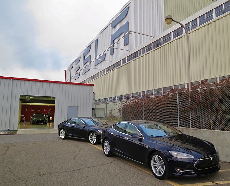
Photo: Steve Jurvetson, CC BY 2.0.
The Tesla Fremont Factory is an automobile manufacturing plant in Fremont, California, United States, operated by Tesla, Inc. The factory originally opened as General Motors' Fremont Assembly in 1962, and then was operated by New United Motor Manufacturing, Inc, a joint venture of GM and Toyota from 1984. Tesla Fremont Factory is situated 1½ miles northeast of A23.
Warm Springs/South Fremont station
Metro station

Photo: Pi.1415926535, CC BY-SA 3.0.
Warm Springs/South Fremont station is a Bay Area Rapid Transit station located in the Warm Springs district of Fremont, California. The station is served by the Orange and Green lines. Warm Springs/South Fremont station is situated 2 miles northeast of A23.
Pacific Commons
Commercial area
Pacific Commons is a master-planned, mixed-use development consisting of 840 acres in Fremont, California currently in development by Catellus Development Corporation. Pacific Commons is situated 2 miles north of A23.
Places in the Area
Nearby places include Drawbridge and Curtner.
Drawbridge
Locality
 Drawbridge is a ghost town with an abandoned railroad station located at the southern end of the San Francisco Bay, next to Station Island, now a part of the city of Fremont, California, United States.
Curtner
Neighborhood
Curtner is a neighborhood of Fremont in Alameda County, California. It lies at an elevation of 30 feet. It was formerly an unincorporated community. Curtner is situated 2 miles east of A23.
Alviso
Suburb

Photo: Vlad Butsky, CC BY 2.0.
Alviso is a district of San Jose, California, located in North San Jose on the southern shores of San Francisco Bay. Originally an independent town, founded in 1852, today Alviso is San Jose's only waterfront district, primarily residential in nature, with several Silicon Valley tech companies and recreation-oriented businesses. Alviso is situated 3½ miles south of A23.
A23
- Type: Pond
- Category: body of water
- Location: Alameda, California, United States, North America
- View on OpenStreetMap
Latitude
37.47577° or 37° 28′ 33″ northLongitude
-121.96158° or 121° 57′ 42″ westOpen location code
849WF2GQ+89OpenStreetMap ID
way 154421847OpenStreetMap feature
landuse=salt_pond
This page is based on OpenStreetMap, Wikidata, and Wikimedia Commons.
We’d love your help improving our open data sources. Thank you for contributing.
Satellite Map
Discover A23 from above in high-definition satellite imagery.
Places with the Same Name
Discover other places named “A23”.
Notable Places Nearby
Highlights include A22 and A19.
Nearby Places
Explore places such as Tandy Leather and Lam Research.
California: Must-Visit Destinations
Delve into San Francisco, Los Angeles, San Diego, and Sacramento.
Curious Ponds to Discover
Uncover intriguing ponds from every corner of the globe.
About Mapcarta. Data © OpenStreetMap contributors and available under the Open Database License". Text is available under the CC BY-SA 4.0 license, except for photos, directions, and the map. Photo: Miskatonic, CC BY 2.5.