Bauunternehmung van Stephoudt
Bauunternehmung van Stephoudt is an office building in Weeze, Kleve, North Rhine-Westphalia which is located on Holtumsweg. Bauunternehmung van Stephoudt is situated nearby to the pitch Basketballplatz Alte Heerstraße, as well as near the church Neuapostolische Kirche.| Tap on a place to explore it |
Places of Interest Nearby
Highlights include Weeze station and St. Cyriakus.
Weeze station
Railway station
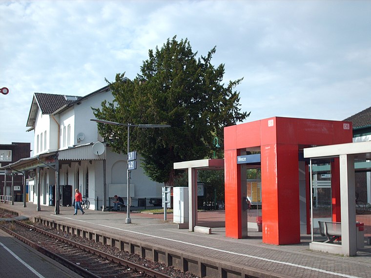
Photo: Stefan Flöper, CC BY-SA 4.0.
Weeze is a railway station in the village of Weeze, North Rhine Westphalia, Germany. The station opened on 5 March 1863 on the Lower Left Rhine Railway. The train services are operated by NordWestBahn. Weeze station is situated 660 metres northwest of Bauunternehmung van Stephoudt.
St. Cyriakus
Church

Photo: Wikimedia, CC BY-SA 3.0.
St. Cyriakus is a church, which is situated 1 km north of Bauunternehmung van Stephoudt.
Schloss Wissen
Castle

Photo: Rainer Lippert, CC0.
Schloss Wissen is a castle, which is situated 1½ km east of Bauunternehmung van Stephoudt.
Places in the Area
Nearby places include Kevelaer and Goch.
Kevelaer

Photo: Pkw98, CC BY-SA 3.0.
Kevelaer is a town in the district of Kleve, in North Rhine-Westphalia in Germany. It is the largest Catholic pilgrimage location within north-western Europe.
Goch
Town
Photo: Pelikana, CC BY-SA 4.0.
Goch is a town in the Kleve district of North Rhine-Westphalia, Germany, close to the border with the Netherlands, 12 km south of Kleve and 27 km southeast of Nijmegen. Goch is situated 7 km northwest of Bauunternehmung van Stephoudt.
Siebengewald
Village
Siebengewald is a village in the municipality of Bergen, in the upper northern part of the province of Limburg, the Netherlands. It is located 27 km southeast of Nijmegen, near the German border. Siebengewald is situated 7 km northwest of Bauunternehmung van Stephoudt.
Bauunternehmung van Stephoudt
- Type: Office building
- Address: Holtumsweg 29, Weeze, 47652
- Categories: building and office
- Location: Weeze, Kleve, Düsseldorf, Lower Rhine, North Rhine-Westphalia, Germany, Central Europe, Europe
- View on OpenStreetMap
Latitude
51.619° or 51° 37′ 8″ northLongitude
6.20188° or 6° 12′ 7″ eastOpen location code
9F38J692+HQOpenStreetMap ID
way 156870135OpenStreetMap feature
building=office
This page is based on OpenStreetMap, Wikidata, and Wikimedia Commons.
We’d love your help improving our open data sources. Thank you for contributing.
Satellite Map
Discover Bauunternehmung van Stephoudt from above in high-definition satellite imagery.
Notable Places Nearby
Highlights include Basketballplatz Alte Heerstraße and Neuapostolische Kirche.
Nearby Places
Explore places such as Jewa-Gas and Paul Grote Bedachungen.
Lower Rhine: Must-Visit Destinations
Delve into Düsseldorf, Mönchengladbach, Krefeld, and Neuss.
Curious Office Buildings to Discover
Uncover intriguing office buildings from every corner of the globe.
About Mapcarta. Data © OpenStreetMap contributors and available under the Open Database License". Text is available under the CC BY-SA 4.0 license, except for photos, directions, and the map. Photo: Wikimedia, CC BY-SA 3.0.