Buckland Fields
Buckland Fields is a farm in Aston Somerville, Wychavon District, England. Buckland Fields is situated nearby to the church St Mary the Virgin, as well as near the pitch Bowls Club.| Tap on a place to explore it |
Places of Interest Nearby
Highlights include Church of St Catherine and Church of St Mary.
Church of St Catherine
Church

Photo: Philip Halling, CC BY-SA 2.0.
Church of St Catherine is situated 1¼ miles southwest of Buckland Fields.
Church of St Mary
Church

Photo: Philip Halling, CC BY-SA 2.0.
Church of St Mary is situated 1¼ miles east of Buckland Fields.
Broadway railway station
Railway station
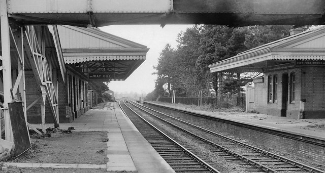
Photo: Ben Brooksbank, CC BY-SA 2.0.
Broadway railway station is a railway station on the heritage Gloucestershire Warwickshire Railway in the village of Broadway in Worcestershire, England. Broadway railway station is situated 2 miles east of Buckland Fields.
Places in the Area
Nearby places include Aston Somerville and Wormington.
Aston Somerville
Village

Photo: Dave Bushell, CC BY-SA 2.0.
Aston Somerville is a small village approximately 3 miles south of Evesham, Worcestershire, England.
Wormington
Village

Photo: Dave Bushell, CC BY-SA 2.0.
Wormington is a village civil parish in the Tewkesbury district, in Gloucestershire, England. It lies on the River Isbourne, 5 miles north of Winchcombe and 6 miles south of Evesham.
Childswickham
Village

Photo: Eveshamsteve, CC BY-SA 3.0.
Childswickham is a village in Worcestershire, England, situated within the flat open landscape of the Vale of Evesham, between the Bredon and Cotswold Hills, two miles from Broadway.
Buckland Fields
- Type: Farm
- Category: agriculture
- Location: Aston Somerville, Wychavon District, Worcestershire, West Midlands, England, United Kingdom, Britain and Ireland, Europe
- View on OpenStreetMap
Latitude
52.03704° or 52° 2′ 13″ northLongitude
-1.92061° or 1° 55′ 14″ westOpen location code
9C4W23PH+RQOpenStreetMap ID
way 163249618OpenStreetMap feature
landuse=farmyard
This page is based on OpenStreetMap, Wikidata, and Wikimedia Commons.
We’d love your help improving our open data sources. Thank you for contributing.
Satellite Map
Discover Buckland Fields from above in high-definition satellite imagery.
Notable Places Nearby
Highlights include St Mary the Virgin and Bowls Club.
Nearby Places
Explore places such as Buckland Fields and Mocho Farm.
Worcestershire: Must-Visit Destinations
Delve into Worcester, Redditch, Kidderminster, and Evesham.
Curious Farms to Discover
Uncover intriguing farms from every corner of the globe.
About Mapcarta. Data © OpenStreetMap contributors and available under the Open Database License". Text is available under the CC BY-SA 4.0 license, except for photos, directions, and the map. Photo: brianac37, CC BY 2.0.