Subestación de Sant Antoni
Subestación de Sant Antoni is an electrical substation in Sant Antoni de Portmany, Balearic Islands, Balearic Islands. Subestación de Sant Antoni is situated nearby to the peak Pujol de Can Ferrer, as well as near Puig des Fogueró.| Tap on a place to explore it |
Places of Interest Nearby
Highlights include Església de Sant Antoni de Portmany.
Església de Sant Antoni de Portmany
Church
 Església de Sant Antoni de Portmany is a church, which is situated 4 km northwest of Subestación de Sant Antoni.
Places in the Area
Nearby places include Sant Agustí des Vedrà and San Rafael.
Sant Agustí des Vedrà
Hamlet
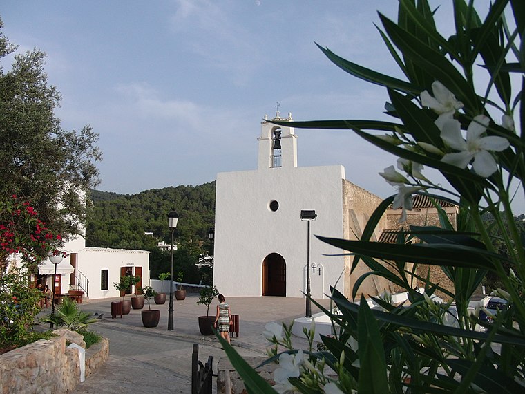
Photo: JanManu, CC BY-SA 3.0.
Sant Agustí des Vedrà is a small village in the West of the Spanish island of Ibiza. The village is in the municipality of Sant Josep de sa Talaia and is located on designated road EI-700. Sant Agustí des Vedrà is situated 4 km southwest of Subestación de Sant Antoni.
San Rafael
Hamlet
 Sant Rafel de sa Creu is a village on the Spanish island of Ibiza. It is off the main road that connects Ibiza Town and San Antonio. San Rafael is situated 5 km east of Subestación de Sant Antoni.
Sa Foradada
Locality

Photo: UnFUG-Fabi, CC0.
Sa Foradada is a locality, which is situated 7 km northwest of Subestación de Sant Antoni.
Subestación de Sant Antoni
- Type: Electrical substation
- Category: industry
- Location: Sant Antoni de Portmany, Balearic Islands, Ibiza, Balearic Islands, Spain, Iberia, Europe
- View on OpenStreetMap
Latitude
38.95725° or 38° 57′ 26″ northLongitude
1.33637° or 1° 20′ 11″ eastOpen location code
8FC3X84P+WGOpenStreetMap ID
way 169478558
This page is based on OpenStreetMap, Wikidata, and Wikimedia Commons.
We’d love your help improving our open data sources. Thank you for contributing.
Satellite Map
Discover Subestación de Sant Antoni from above in high-definition satellite imagery.
Notable Places Nearby
Highlights include Pujol de Can Ferrer and Iglesia de la Sagrada Familia.
Nearby Places
Explore places such as Casa Cecilia and 528 Ibiza.
Ibiza: Must-Visit Destinations
Delve into Ibiza and Santa Eulària des Riu.
Curious Electrical Substations to Discover
Uncover intriguing electrical substations from every corner of the globe.
About Mapcarta. Data © OpenStreetMap contributors and available under the Open Database License". Text is available under the CC BY-SA 4.0 license, except for photos, directions, and the map. Photo: Standardizer, CC BY-SA 3.0.