Campos de El Mortero (La Braña)
Campos de El Mortero (La Braña) is a pitch in Gijón, Asturias. Campos de El Mortero (La Braña) is situated nearby to the spring Fuente del Mortero, as well as near the church Iglesia de Santa Bárbara.| Tap on a place to explore it |
Places of Interest Nearby
Highlights include Gijón Railway Station and Sanctuary of Nuestra Señora de Contrueces.
Gijón Railway Station
Railway station
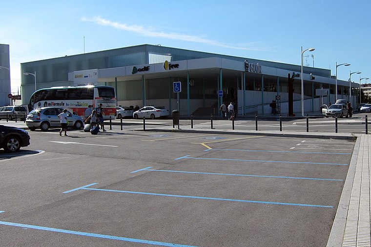
Photo: FDV, CC BY-SA 3.0.
Gijón Railway Station, also known as Gijón Sanz Crespo, is the main railway station of Gijón, Spain. Since 2011 it is located in Sanz Crespo street due to the works for the Metrotrén Asturias project. Gijón Railway Station is situated 2½ km northeast of Campos de El Mortero (La Braña).
Sanctuary of Nuestra Señora de Contrueces
Manor estate

Photo: Adolfobrigido, CC BY-SA 3.0.
The Sanctuary of Our Lady of Contrueces is a Catholic church located in the autonomous community of Asturias, in the southern part of the urban area of Gijón, within the neighborhood of Contrueces. Sanctuary of Nuestra Señora de Contrueces is situated 2½ km east of Campos de El Mortero (La Braña).
Aquarium of Gijón
Public aquarium
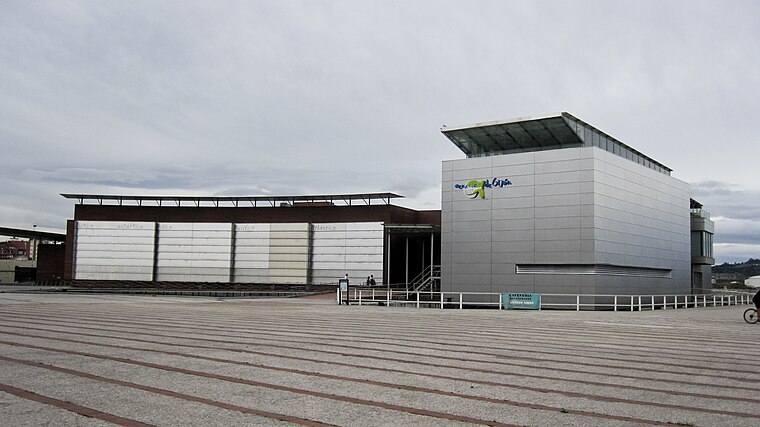
Photo: Xauxa, CC BY-SA 3.0.
Aquarium of Gijón is a public aquarium, which is situated 2½ km northeast of Campos de El Mortero (La Braña).
Places in the Area
Nearby places include Montevil and Pumarín.


Campos de El Mortero (La Braña)
- Type: Pitch
- Categories: recreation area, football, and sports location
- Location: Gijón, Asturias, Green Spain, Spain, Iberia, Europe
- View on OpenStreetMap
Latitude
43.52077° or 43° 31′ 15″ northLongitude
-5.69096° or 5° 41′ 28″ westOpen location code
8CMPG8C5+8JOpenStreetMap ID
way 172091412OpenStreetMap feature
leisure=pitchOpenStreetMap feature
sport=soccer
This page is based on OpenStreetMap, Wikidata, and Wikimedia Commons.
We’d love your help improving our open data sources. Thank you for contributing.
Satellite Map
Discover Campos de El Mortero (La Braña) from above in high-definition satellite imagery.
Notable Places Nearby
Highlights include Campos de El Mortero (La Braña) and Fuente del Mortero.
Nearby Places
Explore places such as Campos de El Mortero (Vestuarios) and Subestación Eléctrica Pumarín.
Asturias: Must-Visit Destinations
Delve into Oviedo, Aviles, Villaviciosa, and Grado.
Curious Pitches to Discover
Uncover intriguing pitches from every corner of the globe.
About Mapcarta. Data © OpenStreetMap contributors and available under the Open Database License". Text is available under the CC BY-SA 4.0 license, except for photos, directions, and the map. Photo: charles lecompte, CC BY-SA 3.0.