Bacherbauer
Bacherbauer is a farm in Lower Austria, Austria. Bacherbauer is situated nearby to the church Kapelle, as well as near the forest Leitenviertel.| Tap on a place to explore it |
Places of Interest Nearby
Highlights include Kirchschlag in der Buckligen Welt and Burgruine Kirchschlag.
Kirchschlag in der Buckligen Welt
Town hall

Photo: Bwag, CC BY-SA 4.0.
Kirchschlag in der Buckligen Welt is a municipality in the district of Wiener Neustadt-Land in the Austrian state of Lower Austria. Kirchschlag in der Buckligen Welt is situated 4 km southeast of Bacherbauer.
Burgruine Kirchschlag
Castle
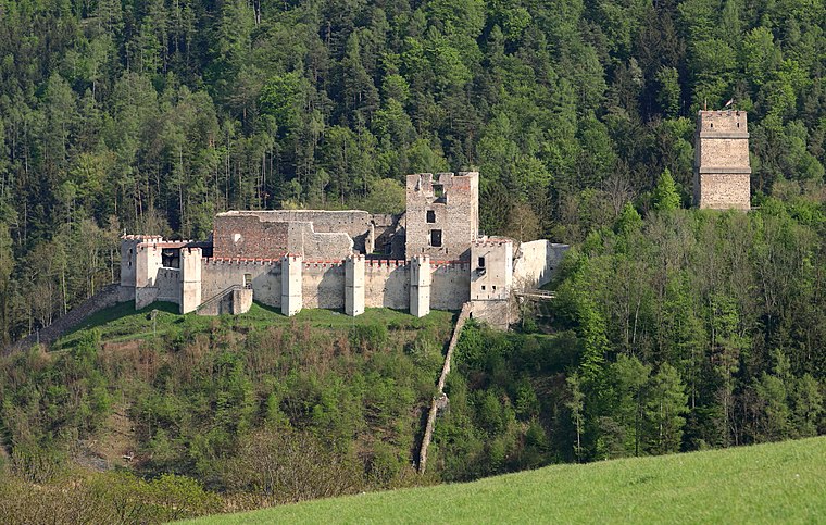
Photo: Bwag, CC BY-SA 4.0.
Burgruine Kirchschlag is a castle, which is situated 4 km southeast of Bacherbauer.
Pfarrkirche hl. Johannes, Kirchschlag
Church
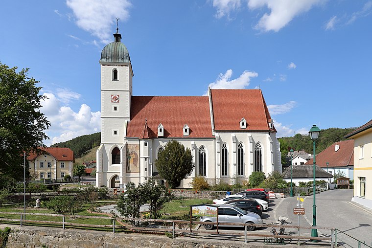
Photo: Bwag, CC BY-SA 4.0.
Pfarrkirche hl. Johannes, Kirchschlag is a church, which is situated 4 km southeast of Bacherbauer.
Places in the Area
Nearby places include Krumbach and Kogl im Burgenland.
Krumbach
Village

Photo: Bwag, CC BY-SA 4.0.
Krumbach is a market town in southern Lower Austria, Austria. It is part of the landscape Bucklige Welt. Krumbach is situated 4½ km west of Bacherbauer.
Kogl im Burgenland
Village

Photo: Nxr-at, CC BY-SA 4.0.
Kogl im Burgenland is a village, which is situated 9 km southeast of Bacherbauer.
Redlschlag
Village

Photo: Steindy, CC BY-SA 2.0 de.
Redlschlag is a village, which is situated 9 km south of Bacherbauer.
Bacherbauer
- Type: Farm
- Category: agriculture
- Location: Lower Austria, Austria, Central Europe, Europe
- View on OpenStreetMap
Latitude
47.51689° or 47° 31′ 1″ northLongitude
16.24916° or 16° 14′ 57″ eastOpen location code
8FVRG68X+QMOpenStreetMap ID
way 173795932OpenStreetMap feature
landuse=farmyard
This page is based on OpenStreetMap, Wikidata, and Wikimedia Commons.
We’d love your help improving our open data sources. Thank you for contributing.
Satellite Map
Discover Bacherbauer from above in high-definition satellite imagery.
Notable Places Nearby
Highlights include Kapelle and Leitenviertel.
Nearby Places
Explore places such as Greml and Taschenhof.
Lower Austria: Must-Visit Destinations
Delve into St. Pölten, Wiener Neustadt, Amstetten, and Klosterneuburg.
Curious Farms to Discover
Uncover intriguing farms from every corner of the globe.
About Mapcarta. Data © OpenStreetMap contributors and available under the Open Database License". Text is available under the CC BY-SA 4.0 license, except for photos, directions, and the map. Photo: Lonezor, CC BY-SA 3.0.