Firdows
Firdows is a clothing store in Birmingham, England which is located on Stratford Road. Firdows is situated nearby to Springfield Post Office, as well as near the mosque Al-Bhokari Education Centre.| Tap on a place to explore it |
Places of Interest Nearby
Highlights include St Christopher’s Church, Springfield and Sparkhill Library.
St Christopher’s Church, Springfield
Church

Photo: Nigel Mykura, CC BY-SA 2.0.
St Christopher's Church, Springfield is a Church of England building in the Anglican Diocese of Birmingham. St Christopher’s Church, Springfield is situated 1,000 feet south of Firdows.
Sparkhill Library
Library
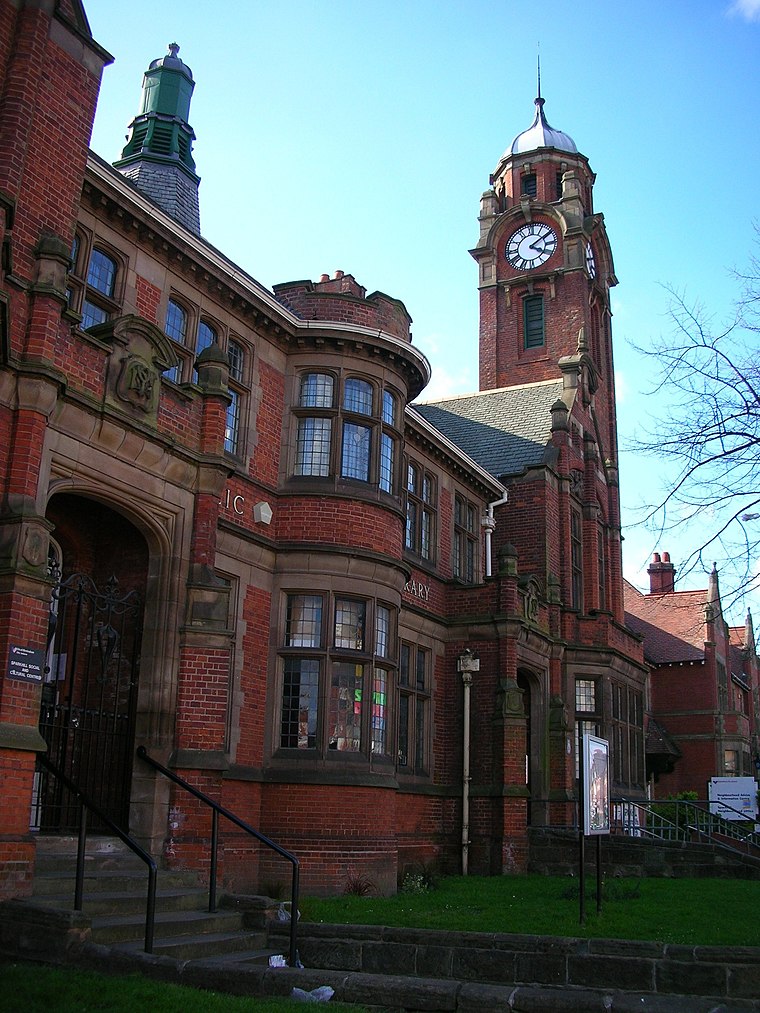
Photo: Oosoom, CC BY-SA 3.0.
Sparkhill Library, formerly Yardley Council House, is a municipal building in Stratford Road in Sparkhill, West Midlands, England. The building, which previously served as the offices of Yardley Rural District Council, now operates as a public library administered by Birmingham City Council. Sparkhill Library is situated 1,800 feet northwest of Firdows.
Moseley School
School

Photo: Oosoom, CC BY-SA 3.0.
Moseley School and Sixth Form is a coeducational secondary school and sixth form located in the Moseley area of Birmingham, England. The school's main entrance is situated on Wake Green Road, with other entrances on College Road and Springfield Road, and it lies in the parish of St Christopher, Springfield. Moseley School is situated 2,000 feet south of Firdows.
Places in the Area
Nearby places include Springfield and Sparkhill.
Springfield
Suburb

Photo: Pigsonthewing, CC BY-SA 3.0.
Springfield is a ward in south east Birmingham, England, created in 2004 from much of the old Sparkhill ward. It is a part of the formal district of Hall Green.
Sparkhill
Suburb
Photo: Oosoom, CC BY-SA 3.0.
Sparkhill is an inner-city area of Birmingham, England, situated between Springfield, Hall Green and Sparkbrook. Historically part of Worcestershire, Sparkhill once existed as a rural area with its main industry being agriculture until the 1880s.
Wake Green
Village
Wake Green is a historical area in south Birmingham, England between Moseley, Kings Heath, and Hall Green. Like nearby Sarehole it is no longer a postal address.
Firdows
- Type: Clothing store
- Address: 717 Stratford Road, Birmingham, B11 4DN
- Categories: building, shop, and retail building
- Location: Birmingham, England, United Kingdom, Britain and Ireland, Europe
- View on OpenStreetMap
Latitude
52.44618° or 52° 26′ 46″ northLongitude
-1.8602° or 1° 51′ 37″ westOpen location code
9C4WC4WQ+FWOpenStreetMap ID
way 173925984OpenStreetMap feature
building=retailOpenStreetMap feature
shop=clothes
This page is based on OpenStreetMap, Wikidata, and Wikimedia Commons.
We’d love your help improving our open data sources. Thank you for contributing.
Satellite Map
Discover Firdows from above in high-definition satellite imagery.
Notable Places Nearby
Highlights include Springfield Post Office and Al-Bhokari Education Centre.
Nearby Places
Explore places such as Kerala Ayuverda Spa Clinic and Subhan Halal Meat Centre.
England: Must-Visit Destinations
Delve into London, Manchester, Sheffield, and Leeds.
Curious Clothing Stores to Discover
Uncover intriguing clothing stores from every corner of the globe.
About Mapcarta. Data © OpenStreetMap contributors and available under the Open Database License". Text is available under the CC BY-SA 4.0 license, except for photos, directions, and the map. Photo: sidibousaid, CC BY 2.0.