Coulée Douce
Coulée Douce is a meadow in Villiers-sur-Orge, Arrondissement of Palaiseau, Île-de-France. Coulée Douce is situated nearby to the dog park Club Canin Villiers-sur-Orge, as well as near the school École maternelle Pierre Brossolette.| Tap on a place to explore it |
Places of Interest Nearby
Highlights include Town hall of Villiers-sur-Orge and Château de Ballainvilliers.
Town hall of Villiers-sur-Orge
Town hall

Photo: Jo simons, Public domain.
Town hall of Villiers-sur-Orge is situated 590 metres southeast of Coulée Douce.
Château de Ballainvilliers
Castle

Photo: Cyrilb1881, CC BY-SA 3.0.
Château de Ballainvilliers is a castle, which is situated 1¼ km north of Coulée Douce.
Sainte-Geneviève-des-Bois station
Railway station
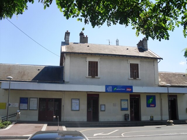
Photo: Cyrilb1881, CC BY-SA 3.0.
Sainte-Geneviève-des-Bois is a railway station in Sainte-Geneviève-des-Bois, Essonne, Paris, France. The station was opened in 1881 and is on the Paris–Bordeaux railway. Sainte-Geneviève-des-Bois station is situated 1½ km southeast of Coulée Douce.
Places in the Area
Nearby places include La Ville-du-Bois and Épinay-sur-Orge.
La Ville-du-Bois
Village

Photo: Gallipato, CC BY-SA 3.0.
La Ville-du-Bois is a commune in the southern suburbs of Paris, France. It is located 23 km from the center of Paris.
Épinay-sur-Orge
Town

Photo: Cyrilb1881, CC BY-SA 4.0.
Épinay-sur-Orge is a commune in the Essonne department in Île-de-France in northern France. It is situated near Orly Airport some 17 km south of Paris on the A6 motorway. Épinay-sur-Orge is situated 2½ km northeast of Coulée Douce.
Villemoisson-sur-Orge
Village
 Villemoisson-sur-Orge is a commune in the Essonne department in Île-de-France in northern France. Villemoisson-sur-Orge is situated 2½ km east of Coulée Douce.
Coulée Douce
- Type: Meadow
- Location: Villiers-sur-Orge, Arrondissement of Palaiseau, Essonne, Île-de-France, France, Europe
- View on OpenStreetMap
Latitude
48.66153° or 48° 39′ 42″ northLongitude
2.29491° or 2° 17′ 42″ eastOpen location code
8FW4M76V+JXOpenStreetMap ID
way 174300409OpenStreetMap feature
landuse=meadow
This page is based on OpenStreetMap, Wikidata, and Wikimedia Commons.
We’d love your help improving our open data sources. Thank you for contributing.
Satellite Map
Discover Coulée Douce from above in high-definition satellite imagery.
Places with the Same Name
Discover other places named “Coulée Douce”.
Notable Places Nearby
Highlights include Plantation participative de la Coulée Douce and Club Canin Villiers-sur-Orge.
Nearby Places
Explore places such as Établissement Leneindre and ZA Pointe à l’Abbé.
Île-de-France: Must-Visit Destinations
Delve into Paris, Versailles, Boulogne-Billancourt, and Paris Charles de Gaulle Airport.
Curious Meadows to Discover
Uncover intriguing meadows from every corner of the globe.
About Mapcarta. Data © OpenStreetMap contributors and available under the Open Database License". Text is available under the CC BY-SA 4.0 license, except for photos, directions, and the map. Photo: Olybrius, CC BY-SA 3.0.