FSA-Systeme
FSA-Systeme is an automobile repair shop in Mannheim, Karlsruhe Region, Baden-Württemberg which is located on Münchwälderstraße. FSA-Systeme is situated nearby to the railway station Mannheim-Rheinau station, as well as near the fire station Feuerwache Süd.| Tap on a place to explore it |
- Email: info@fsa-systeme.de
- Type: Automobile repair shop
- Address: Münchwälderstraße 4
Places of Interest Nearby
Highlights include Mannheim-Rheinau station and St.-Johannes-Kirche (Mannheim).
Mannheim-Rheinau station
Railway station
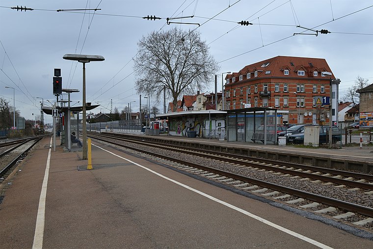
Photo: Telford, CC BY-SA 3.0.
Mannheim-Rheinau station is a railway station, which is situated 180 metres north of FSA-Systeme.
St.-Johannes-Kirche (Mannheim)
Church

Photo: Frank-m, CC BY-SA 3.0.
St.-Johannes-Kirche (Mannheim) is a church, which is situated 580 metres south of FSA-Systeme.
Martinskirche
Church

Photo: Frank-m, CC BY-SA 3.0.
Martinskirche is a church, which is situated 630 metres southwest of FSA-Systeme.
Places in the Area
Nearby places include Altrip and Brühl.
Altrip
Village

Photo: Immanuel Giel, Public domain.
Altrip is a municipality in the Rhein-Pfalz-Kreis, in Rhineland-Palatinate, Germany. It is situated on the left bank of the Rhine, approx. 7 km southeast of Ludwigshafen. The population in 2022 was 7,728. Altrip is situated 3 km northwest of FSA-Systeme.
Brühl
Town

Photo: Frank-m, CC BY-SA 2.5.
Brühl is a municipality in the Rhein-Neckar district of Baden-Württemberg, Germany. The former fishing village along the Rhine has become a satellite of a growing Mannheim. Brühl is situated 3 km south of FSA-Systeme.

FSA-Systeme
- Categories: commerce, shop, and transportation
- Location: Mannheim, Karlsruhe Region, Rhine-Neckar, Baden-Württemberg, Germany, Central Europe, Europe
- View on OpenStreetMap
Latitude
49.42224° or 49° 25′ 20″ northLongitude
8.53469° or 8° 32′ 5″ eastOperator
Kurt KalinowiczOpen location code
8FXCCGCM+VVOpenStreetMap ID
way 174662603OpenStreetMap feature
landuse=commercialOpenStreetMap feature
shop=car_repair
This page is based on OpenStreetMap, Wikidata, and Wikimedia Commons.
We’d love your help improving our open data sources. Thank you for contributing.
Satellite Map
Discover FSA-Systeme from above in high-definition satellite imagery.
Notable Places Nearby
Highlights include Feuerwache Süd and Freiwillige Feuerwehr Rheinau.
Nearby Places
Explore places such as u.m.o. KFZ-Reinigungs-Center and Ertas Bau GmbH.
Rhine-Neckar: Must-Visit Destinations
Delve into Heidelberg, Karlsruhe, Heilbronn, and Sinsheim.
Curious Automobile Repair Shops to Discover
Uncover intriguing automobile repair shops from every corner of the globe.
About Mapcarta. Data © OpenStreetMap contributors and available under the Open Database License". Text is available under the CC BY-SA 4.0 license, except for photos, directions, and the map. Photo: HubiB, CC BY 2.5.