Bede’s Prep School
Bede’s Prep School is a school building in Eastbourne District, East Sussex, England. Bede’s Prep School is situated nearby to the pitch Bede’s Prep Basketball, as well as near Bede’s Prep Astro Turf.| Tap on a place to explore it |
Places of Interest Nearby
Highlights include St Andrew’s Prep and St John the Evangelist.
St Andrew’s Prep
School
St Andrew's Prep is an independent boarding and day school for boys and girls aged 9 months to 13 years in Meads, Eastbourne, East Sussex on the south coast of England. St Andrew’s Prep is situated 790 feet northwest of Bede’s Prep School.
St John the Evangelist
Church

Photo: The Voice of Hassocks, Public domain.
St John the Evangelist is a church, which is situated 2,300 feet northeast of Bede’s Prep School.
Wish Tower

Photo: Simon Burchell, CC BY-SA 4.0.
Wish Tower is situated 1 mile northeast of Bede’s Prep School.
Places in the Area
Nearby places include Eastbourne and Friston.
Eastbourne

Photo: Diliff, CC BY-SA 3.0.
Eastbourne is a popular and traditional sea-side resort town in East Sussex, on England's South East coast. It has one of the highest recorded days of sunshine per year in Britain and its climate is notable for its relatively high sunshine levels, with the town claiming to be the "Sunniest Place in the UK".
Friston
Village
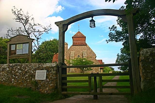
Photo: Toby Speight, CC BY-SA 2.0.
Friston is a village, which is situated 3 miles west of Bede’s Prep School.
Westdean
Village

Photo: Ian Cunliffe, CC BY-SA 2.0.
Westdean is a village, which is situated 5 miles west of Bede’s Prep School.
Bede’s Prep School
- Type: School building
- Categories: building and education
- Location: Eastbourne District, East Sussex, South East England, England, United Kingdom, Britain and Ireland, Europe
- View on OpenStreetMap
Latitude
50.75212° or 50° 45′ 8″ northLongitude
0.26817° or 0° 16′ 5″ eastOpen location code
9F22Q729+R7OpenStreetMap ID
way 185754567OpenStreetMap feature
building=school
This page is based on OpenStreetMap, Wikidata, and Wikimedia Commons.
We’d love your help improving our open data sources. Thank you for contributing.
Satellite Map
Discover Bede’s Prep School from above in high-definition satellite imagery.
Notable Places Nearby
Highlights include Bede’s Prep Basketball and Bede’s Prep Astro Turf.
Nearby Places
Explore places such as Holywell Mount and Cadence Clubhouse.
East Sussex: Must-Visit Destinations
Delve into Brighton, Eastbourne, Hastings, and Lewes.
Curious Schools to Discover
Uncover intriguing schools from every corner of the globe.
About Mapcarta. Data © OpenStreetMap contributors and available under the Open Database License". Text is available under the CC BY-SA 4.0 license, except for photos, directions, and the map. Photo: matthewhartley369, CC BY-SA 2.0.