LOCK’O
LOCK’O is a building in Gembloux, Arrondissement of Namur, Wallonia which is located on Rue des Praules. LOCK’O is situated nearby to the fire station Zone de Secours NAGE - Poste Gembloux, as well as near the police station Zone de Police Orneau-Mehaigne.| Tap on a place to explore it |
Places of Interest Nearby
Highlights include Gembloux Abbey and Gembloux railway station.
Gembloux Abbey
University
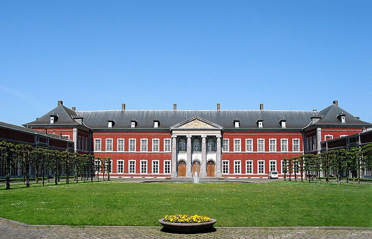 Gembloux Abbey was a Benedictine abbey near Gembloux in the province of Namur, Wallonia, Belgium. Since 1860, its buildings host the University of Liège's Gembloux Agro-Bio Tech faculty and campus. Gembloux Abbey is situated 2½ km southwest of LOCK’O.
Gembloux railway station
Railway station

Photo: Eebie, CC BY-SA 4.0.
Gembloux railway station is a railway station in Gembloux, Namur, Belgium. The station was opened on 14 June 1855 by the Grande Compagnie de Luxembourg on railway lines 144, 147 and 161. Gembloux railway station is situated 2 km southwest of LOCK’O.
Gembloux Agro-Bio Tech
University
Gembloux Agro-Bio Tech, located in Gembloux, Belgium, is one of the eleven faculties of the University of Liège. Founded in 1860 and previously known as the Faculté universitaire des sciences agronomiques de Gembloux, it is Belgium's oldest educational and research institution dedicated to agronomic sciences and biological engineering. Gembloux Agro-Bio Tech is situated 2½ km southwest of LOCK’O.
Places in the Area
Nearby places include Sauvenière and Ernage.

Ernage
Village

Photo: Djozewal, CC BY-SA 4.0.
Ernage is a village, which is situated 3 km northwest of LOCK’O.
Walhain-Saint-Paul
Village

Photo: EmDee, CC BY-SA 3.0.
Walhain-Saint-Paul is a village, which is situated 4½ km north of LOCK’O.
LOCK’O
- Type: Building
- Address: Rue des Praules 2, Gembloux, 5030
- Location: Gembloux, Arrondissement of Namur, Namur, Wallonia, Belgium, Benelux, Europe
- View on OpenStreetMap
Latitude
50.57997° or 50° 34′ 48″ northLongitude
4.71279° or 4° 42′ 46″ eastOpen location code
9F26HPH7+X4OpenStreetMap ID
way 186782541OpenStreetMap feature
building=yes
This page is based on OpenStreetMap, Wikidata, and Wikimedia Commons.
We’d love your help improving our open data sources. Thank you for contributing.
Satellite Map
Discover LOCK’O from above in high-definition satellite imagery.
Notable Places Nearby
Highlights include Zone de Secours NAGE - Poste Gembloux and Zone de Police Orneau-Mehaigne.
Nearby Places
Explore places such as Water & Laser Cutting and Water & Laser Cutting.
Curious Buildings to Discover
Uncover intriguing buildings from every corner of the globe.
About Mapcarta. Data © OpenStreetMap contributors and available under the Open Database License". Text is available under the CC BY-SA 4.0 license, except for photos, directions, and the map. Photo: Jeanhousen, CC BY-SA 3.0.