IFNHH/Sport and Exercise Science
IFNHH/Sport and Exercise Science is a school building in Auckland Region, North Island. IFNHH/Sport and Exercise Science is situated nearby to the bus station Massey Shuttle bus, as well as near Year 3 & 4 Playground.| Tap on a place to explore it |
Places of Interest Nearby
Highlights include North Harbour Stadium and Brookfield Park.
North Harbour Stadium
Stadium
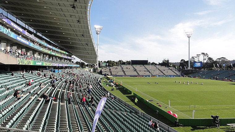 North Harbour Stadium is a stadium situated in Albany, in North Shore City, New Zealand. It was opened in 1997, after nearly a decade of discussion, planning and construction. North Harbour Stadium is situated 1¼ km northeast of IFNHH/Sport and Exercise Science.
Brookfield Park
Park

Photo: Bjankuloski06, CC BY 4.0.
Brookfield Park is situated 550 metres southeast of IFNHH/Sport and Exercise Science.

Places in the Area
Nearby places include Albany Village and North Harbour.

North Harbour
Locality
Rosedale is a suburb on the North Shore of Auckland, New Zealand. It is located 12 kilometres north of the city centre, to the south of the suburbs of Pinehill and Albany.
Lucas Heights
Suburb
Lucas Heights is one of the northernmost suburbs of the contiguous Auckland metropolitan area in New Zealand. It is on the North Shore, directly west of Albany, and is located in the Albany ward for local government purposes.
IFNHH/Sport and Exercise Science
- Type: School building
- Categories: building and education
- Location: Auckland Region, North Island, New Zealand, Oceania
- View on OpenStreetMap
Latitude
-36.73442° or 36° 44′ 4″ southLongitude
174.69191° or 174° 41′ 31″ eastOpen location code
4VMP7M8R+6QOpenStreetMap ID
way 189798918OpenStreetMap feature
building=school
This page is based on OpenStreetMap, Wikidata, and Wikimedia Commons.
We’d love your help improving our open data sources. Thank you for contributing.
Satellite Map
Discover IFNHH/Sport and Exercise Science from above in high-definition satellite imagery.
Notable Places Nearby
Highlights include Massey Shuttle bus and Year 3 & 4 Playground.
Nearby Places
Explore places such as Seminar rooms OR8, OR9 and OR10 and 80 IFNHH Reception.
Auckland Region: Must-Visit Destinations
Delve into Auckland, Central Auckland, Auckland Airport, and North Shore.
Curious Places to Discover
Uncover intriguing places from every corner of the globe.
About Mapcarta. Data © OpenStreetMap contributors and available under the Open Database License". Text is available under the CC BY-SA 4.0 license, except for photos, directions, and the map. Photo: Wikimedia, CC0.