DRK Rettungswache Kehl
DRK Rettungswache Kehl is an ambulance station in Kehl, Ortenaukreis, Baden-Württemberg which is located on Kanzmattstraße. DRK Rettungswache Kehl is situated nearby to the river Altrhein, as well as near the stadium Rheinstadion.| Tap on a place to explore it |
Places of Interest Nearby
Highlights include Weißtannenturm and Stadthalle Kehl.
Weißtannenturm

Photo: AlterVista, CC BY-SA 3.0.
Weißtannenturm is situated 360 metres southwest of DRK Rettungswache Kehl.
Stadthalle Kehl
Community center
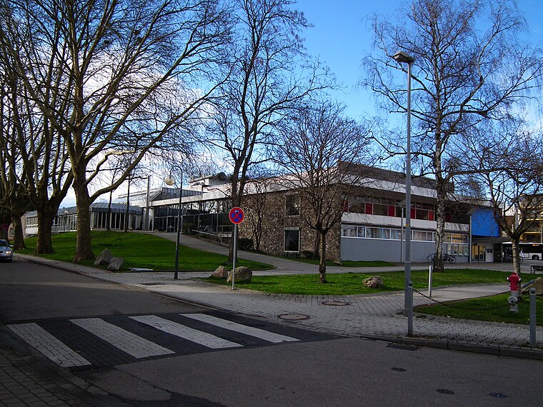
Photo: 4028mdk09, CC BY-SA 3.0.
Stadthalle Kehl is a community center, which is situated 480 metres north of DRK Rettungswache Kehl.
St. Johannes Nepomuk
Church

Photo: Sami Mlouhi, CC BY-SA 4.0.
St. Johannes Nepomuk is a church, which is situated 520 metres northwest of DRK Rettungswache Kehl.
Places in the Area
Nearby places include Neuhof and Strasbourg.
Neuhof
Suburb
Neuhof is a suburb in the southern district of the French city of Strasbourg. Administratively, it is part of "Neuhof, Stockfeld, Ganzau" one of the ten districts of Strasbourg. Neuhof is situated 4½ km southwest of DRK Rettungswache Kehl.
Strasbourg

Photo: stefano Merli, CC BY-SA 2.0.
Strasbourg, in Alsace, is the capital of the Grand-Est region of France and is most widely known for hosting a number of important European institutions.
Petite France
Neighborhood

Photo: Ctruongngoc, CC BY-SA 3.0.
The Petite France, in Alsatian dialect: Französel; "Little France"), also known as the Quartier des Tanneurs is the south-western part of the Grande Île of Strasbourg in Alsace in eastern France, the most central and characteristic island of the city that forms the historic center. Petite France is situated 5 km west of DRK Rettungswache Kehl.
DRK Rettungswache Kehl
- Type: Ambulance station
- Address: Kanzmattstraße 4, Kehl, 77694
- Categories: building and health care
- Location: Kehl, Ortenaukreis, Freiburg Region, Black Forest, Baden-Württemberg, Germany, Central Europe, Europe
- View on OpenStreetMap
Latitude
48.56772° or 48° 34′ 4″ northLongitude
7.81315° or 7° 48′ 47″ eastBrand
German Red CrossOperator
Rettungsdienst Ortenau gGmbHOpen location code
8FW9HR97+37OpenStreetMap ID
way 202750093OpenStreetMap feature
building=yes
This page is based on OpenStreetMap, Wikidata, and Wikimedia Commons.
We’d love your help improving our open data sources. Thank you for contributing.
Satellite Map
Discover DRK Rettungswache Kehl from above in high-definition satellite imagery.
Notable Places Nearby
Highlights include Altrhein and Rheinstadion.
Nearby Places
Explore places such as DRK Ortsverein Kehl e.V. and Kehl, Ortenau Klinikum.
Black Forest: Must-Visit Destinations
Delve into Freiburg, Baden-Baden, Pforzheim, and Villingen-Schwenningen.
Curious Ambulance Stations to Discover
Uncover intriguing ambulance stations from every corner of the globe.
About Mapcarta. Data © OpenStreetMap contributors and available under the Open Database License". Text is available under the CC BY-SA 4.0 license, except for photos, directions, and the map. Photo: Wikimedia, CC BY-SA 4.0.