S.L. Raheja Hospital
S.L. Raheja Hospital is a hospital in Mumbai, Maharashtra which is located on SL Raheja Hospital Marg. S.L. Raheja Hospital is situated nearby to Mahim Police Hospital, as well as near the college Xavier Institute of Engineering.| Tap on a place to explore it |
Places of Interest Nearby
Highlights include Mahim Fort and St. Michael’s Church.
Mahim Fort
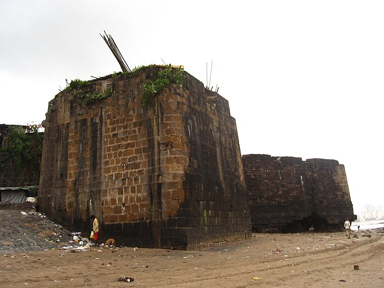
Photo: Nichalp, CC BY-SA 3.0.
The Mahim Fort is a fort in Mahim in Mumbai, Maharashtra state, India. Strategically located on the Mahim Bay, the fort overlooks Worli to the south, Bandra to the north, and Mahim to the east. Mahim Fort is situated 670 metres southwest of S.L. Raheja Hospital.
St. Michael’s Church
Church

Photo: Nichalp, CC BY-SA 3.0.
St. Michael's Church is one of the oldest Catholic churches in the Mahim suburb of Mumbai, India. Because the church is at the junction of LJ Road and Mahim Causeway it is sometimes referred to as Mahim Church. St. Michael’s Church is situated 440 metres southwest of S.L. Raheja Hospital.
Mahim Junction railway station
Railway station
 Mahim Junction is an Indian railway station on the Western line and Harbour Line of the Mumbai Suburban Railway network. It serves the last town of the Mumbai City district, Mahim. Mahim Junction railway station is situated 770 metres southeast of S.L. Raheja Hospital.
Places in the Area
Nearby places include Mahim and Dharavi.
Mahim
Suburb
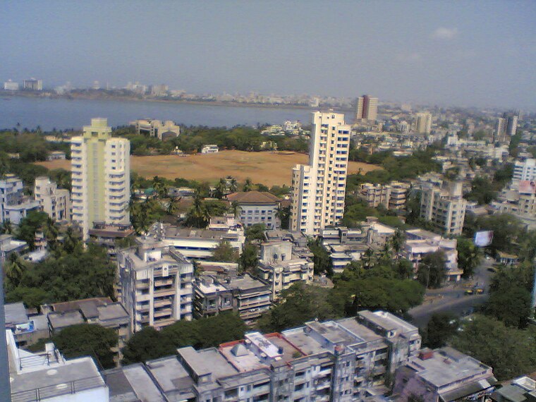
Photo: Mehulsg, CC BY-SA 3.0.
Mahim is a neighbourhood in Mumbai, Maharashtra, India. The Mahim Junction railway station on the Western Railway and Harbour Railway of the Mumbai Suburban Railway network is the last station of the city, as neighboring Bandra is part of Mumbai Suburb.
Dharavi
Locality
 Dharavi is a residential area in Mumbai, Maharashtra, India. It has often been considered one of the world's largest slums. Dharavi has an area of just over 2.39 square kilometres and a population of about 1,000,000.
Bandra
Suburb
Photo: Ranga27, CC BY-SA 3.0.
Bandra is a coastal suburb located in Mumbai, the largest city of the Konkan division in Maharashtra, India. The area is located to the immediate north of the River Mithi, which separates Bandra from the Mumbai City district.
S.L. Raheja Hospital
- Type: Hospital
- Address: SL Raheja Hospital Marg, Mumbai, Maharashtra 400016
- Category: health care
- Location: Mumbai, Mumbai District, Maharashtra, Western India, India, South Asia, Asia
- View on OpenStreetMap
Latitude
19.04641° or 19° 2′ 47″ northLongitude
72.8425° or 72° 50′ 33″ eastOpen location code
7JFJ2RWR+HXOpenStreetMap ID
way 202918725OpenStreetMap feature
amenity=hospitalOpenStreetMap feature
healthcare=hospital
This page is based on OpenStreetMap, Wikidata, and Wikimedia Commons.
We’d love your help improving our open data sources. Thank you for contributing.
Satellite Map
Discover S.L. Raheja Hospital from above in high-definition satellite imagery.
Notable Places Nearby
Highlights include Mahim Police Hospital and Xavier Institute of Engineering.
Nearby Places
Explore places such as S. L. Raheja Hospital Blood Bank and Dr. Akash Dhuru - Cancer Specialist Surgeon.
Maharashtra: Must-Visit Destinations
Delve into Mumbai, Pune, Nagpur, and Nashik.
Curious Hospitals to Discover
Uncover intriguing hospitals from every corner of the globe.
About Mapcarta. Data © OpenStreetMap contributors and available under the Open Database License". Text is available under the CC BY-SA 4.0 license, except for photos, directions, and the map. Photo: Mangeshjadhav, CC BY-SA 3.0.