Tintenmarkt
Tintenmarkt is a building in Worms, Rhenish Hesse, Rhineland-Palatinate which is located on Im Winkel. Tintenmarkt is situated nearby to the pitch SG Kickers, as well as near the health club Active Academy.| Tap on a place to explore it |
Places of Interest Nearby
Highlights include Old Jewish cemetery “Holy Sand” and Worms Cathedral.
Old Jewish cemetery “Holy Sand”
Protected area
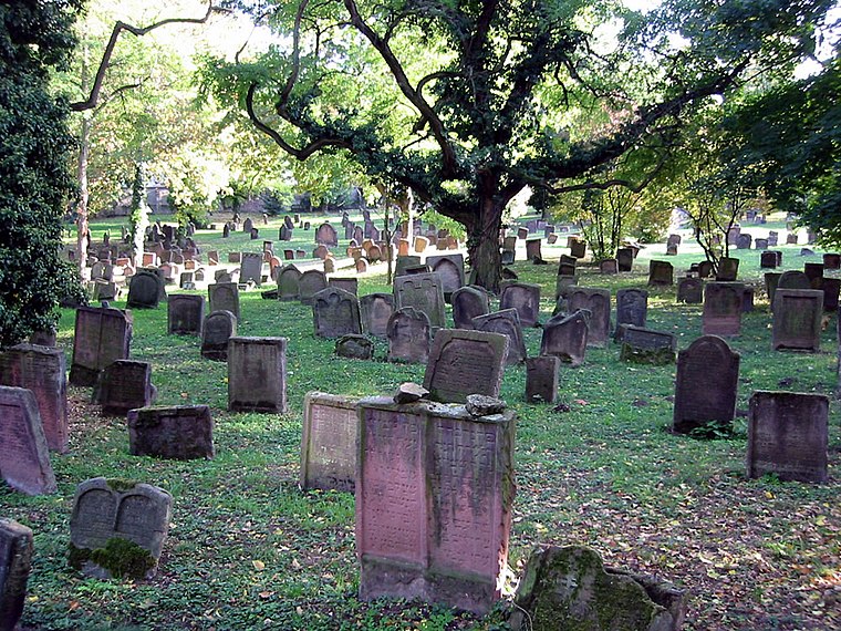
Photo: PanchoS, Public domain.
The Jewish Cemetery in Worms or Heiliger Sand, in Worms, Germany, is usually called the oldest surviving Jewish cemetery in Europe, although the Jewish burials in the Jewish sections of the Roman catacombs predate it by a millennium. Old Jewish cemetery “Holy Sand” is situated 1¼ km north of Tintenmarkt.
Worms Cathedral
Church
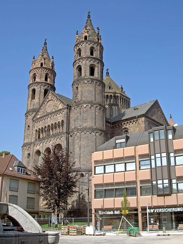
Photo: Wikimedia, CC BY-SA 3.0.
St Peter's Cathedral is a Roman Catholic church and former cathedral in Worms, southern Germany. The cathedral is located on the highest point of the inner city of Worms and is the most important building of the Romanesque style in Worms. Worms Cathedral is situated 1½ km northeast of Tintenmarkt.
Luther Monument

Photo: Immanuel Giel, Public domain.
The Luther Monument is a group of statues that was erected in Worms, Rhineland-Palatinate, Germany, to commemorate the Protestant reformer Martin Luther. Luther Monument is situated 2 km north of Tintenmarkt.
Places in the Area
Nearby places include Trinity Church, Worms and Horchheim.
Trinity Church, Worms
Locality

Photo: Immanuel Giel, Public domain.
The Holy Trinity Church, full name Reformation Memorial Church of the Holy Trinity is the largest Protestant church in Worms. The baroque hall building is centrally located on the market square of the city and is now under conservation.

Pfiffligheim
Suburb

Photo: Jivee Blau, CC BY-SA 3.0.
Pfiffligheim is a suburb, which is situated 3 km northwest of Tintenmarkt.
Tintenmarkt
- Type: Building
- Address: Im Winkel 22, Worms, 67547
- Location: Worms, Rhenish Hesse, Rhineland-Palatinate, Germany, Central Europe, Europe
- View on OpenStreetMap
Latitude
49.61768° or 49° 37′ 4″ northLongitude
8.35097° or 8° 21′ 4″ eastOpen location code
8FXCJ992+39OpenStreetMap ID
way 206354662OpenStreetMap feature
building=yes
This page is based on OpenStreetMap, Wikidata, and Wikimedia Commons.
We’d love your help improving our open data sources. Thank you for contributing.
Satellite Map
Discover Tintenmarkt from above in high-definition satellite imagery.
Notable Places Nearby
Highlights include SG Kickers and Active Academy.
Nearby Places
Explore places such as Magic Cars and CARSLAN.
Rhenish Hesse: Must-Visit Destinations
Delve into Mainz, Bingen, Ingelheim, and Oppenheim.
Curious Buildings to Discover
Uncover intriguing buildings from every corner of the globe.
About Mapcarta. Data © OpenStreetMap contributors and available under the Open Database License". Text is available under the CC BY-SA 4.0 license, except for photos, directions, and the map. Photo: Pratz53, CC BY-SA 4.0.