Cantina di Carpi
Cantina di Carpi is a winery in Soliera, Modena, Emilia-Romagna. Cantina di Carpi is situated nearby to the park Parco degli Scrittori Latini, as well as near Parco Città d’Europa.| Tap on a place to explore it |
Places of Interest Nearby
Highlights include Carpi railway station and Stadio Sandro Cabassi.
Carpi railway station
Railway station
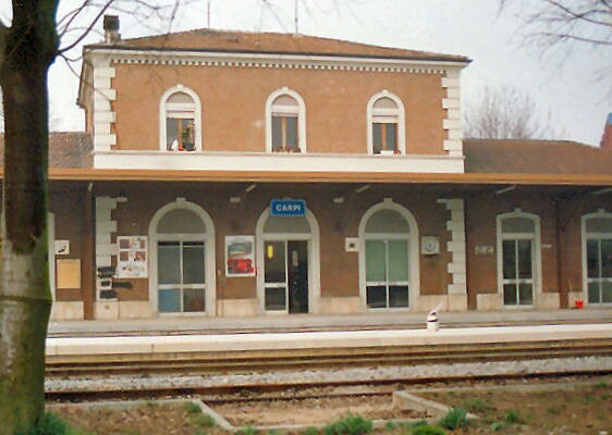 Carpi railway station is situated 1 km northwest of Cantina di Carpi.
Stadio Sandro Cabassi
Stadium
Stadio Sandro Cabassi, is a multi-purpose stadium in Carpi, Italy. It is mainly used mostly for football matches and hosts the home matches of Carpi F.C. 1909. The stadium has a capacity of 5,510 spectators. Stadio Sandro Cabassi is situated 2 km west of Cantina di Carpi.
Teatro Comunale
Theater building

Photo: Nike33, CC BY-SA 4.0.
Teatro Comunale is a theater building, which is situated 1½ km west of Cantina di Carpi.
Places in the Area
Nearby places include Carpi and Soliera.
Carpi
 Carpi is a city in Modena Province, in Italy's Po valley 20 km north of the provincial capital Modena.
Soliera
Town

Photo: Annovi.frizio, CC BY-SA 3.0.
Soliera is a comune in the Province of Modena in the Italian region Emilia-Romagna, located about 40 kilometres northwest of Bologna and about 9 kilometres north of Modena. Soliera is situated 5 km south of Cantina di Carpi.
Fossoli
Village
Fossoli is an Italian village and hamlet of Carpi, a city and municipality of the province of Modena, Emilia-Romagna. It is infamous for the eponymous concentration camp and has a population of about 4400. Fossoli is situated 5 km north of Cantina di Carpi.
Cantina di Carpi
- Type: Winery
- Categories: industry, workshop, and agriculture
- Location: Soliera, Modena, Emilia-Romagna, Northeast Italy, Italy, Europe
- View on OpenStreetMap
Latitude
44.77892° or 44° 46′ 44″ northLongitude
10.90437° or 10° 54′ 16″ eastOpen location code
8FPGQWH3+HPOpenStreetMap ID
way 208388125OpenStreetMap feature
craft=wineryOpenStreetMap feature
landuse=industrial
This page is based on OpenStreetMap, Wikidata, and Wikimedia Commons.
We’d love your help improving our open data sources. Thank you for contributing.
Satellite Map
Discover Cantina di Carpi from above in high-definition satellite imagery.
Notable Places Nearby
Highlights include Parco degli Scrittori Latini and Parco Città d’Europa.
Nearby Places
Explore places such as Scuola dell’infanzia Balena Blu and Q8.
Curious Wineries to Discover
Uncover intriguing wineries from every corner of the globe.
About Mapcarta. Data © OpenStreetMap contributors and available under the Open Database License". Text is available under the CC BY-SA 4.0 license, except for photos, directions, and the map. Photo: Wikimedia, CC0.