St Elizabeth’s Catholic Primary School
St Elizabeth’s Catholic Primary School is a school in Richmond upon Thames, Greater London, England which is located on Queen’s Road. St Elizabeth’s Catholic Primary School is situated nearby to the park Grove Road Gardens, as well as near Christ’s School.| Tap on a place to explore it |
- Type: School
- Denomination: Roman Catholic
- Description: school in Richmond upon Thames, UK
- Address: Queen’s Road, Richmond, TW10 6HN
Places of Interest Nearby
Highlights include Pesthouse Common and St Matthias Church, Richmond.
Pesthouse Common
Park

Photo: Loz Pycock, CC BY-SA 2.0.
Pesthouse Common, Richmond is an area of public open space on Queen's Road, Richmond in the London Borough of Richmond upon Thames. It is bordered by mature lime and horse chestnut trees and is managed by Richmond upon Thames London Borough Council to promote nature conservation. Pesthouse Common is situated 1,100 feet north of St Elizabeth’s Catholic Primary School.
St Matthias Church, Richmond
Church

Photo: Norman21, CC BY-SA 3.0.
St Matthias Church is a Grade II listed Anglican church in Richmond, London. It was built in the Victorian Gothic style in 1857, and is described by Bridget Cherry and Nikolaus Pevsner as "the grandest church in Richmond". St Matthias Church, Richmond is situated 1,200 feet west of St Elizabeth’s Catholic Primary School.
Richmond & East Sheen Cemeteries
Cemetery

Photo: HJ Mitchell, CC BY 4.0.
Richmond Cemetery is a cemetery on Lower Grove Road in Richmond in the London Borough of Richmond upon Thames, England. It opened in 1786 on a plot of land granted by an Act of Parliament the previous year. Richmond & East Sheen Cemeteries is situated 1,200 feet northeast of St Elizabeth’s Catholic Primary School.
Places in the Area
Nearby places include Richmond and Richmond-Kew.
Richmond
Town
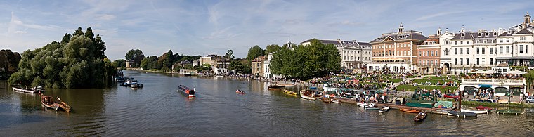
Photo: Diliff, CC BY-SA 3.0.
Richmond is a town in south-west London, 8.2 miles west-south-west of Charing Cross. It stands on the River Thames, and features many parks and open spaces, including Richmond Park, and many protected conservation areas, which include much of Richmond Hill.
Richmond-Kew

Photo: Diliff, CC BY-SA 3.0.
Richmond-Kew is a district in south-west London. This is perhaps the area of outer London with the most to offer visitors.
North Sheen
Suburb

Photo: Hassocks5489, Public domain.
North Sheen is an area of London, England in the former Municipal Borough of Richmond. It was incorporated into Kew in 1965 when the London Borough of Richmond upon Thames was created.
St Elizabeth’s Catholic Primary School
- Categories: voluntary aided school, primary school, and education
- Location: Richmond upon Thames, Greater London, England, United Kingdom, Britain and Ireland, Europe
- View on OpenStreetMap
Latitude
51.45678° or 51° 27′ 24″ northLongitude
-0.29034° or 0° 17′ 25″ westOpen location code
9C3XFP45+PVOpenStreetMap ID
way 210873192OpenStreetMap feature
amenity=schoolOpenStreetMap attribute
denomination=roman_catholicWikidata ID
Q67147834
This page is based on OpenStreetMap, Wikidata, and Wikimedia Commons.
We’d love your help improving our open data sources. Thank you for contributing.
Satellite Map
Discover St Elizabeth’s Catholic Primary School from above in high-definition satellite imagery.
Places with the Same Name
Discover other places named “St Elizabeth’s Catholic Primary School”.
Notable Places Nearby
Highlights include Grove Road Gardens and Christ’s School.
Nearby Places
Explore places such as Marchmont Road and Park Road.
England: Must-Visit Destinations
Delve into London, Manchester, Sheffield, and Leeds.
Curious Schools to Discover
Uncover intriguing schools from every corner of the globe.
About Mapcarta. Data © OpenStreetMap contributors and available under the Open Database License". Text is available under the CC BY-SA 4.0 license, except for photos, directions, and the map. Photo: sidibousaid, CC BY 2.0.