Filston Farm
Filston Farm is a farm in Kent, South East England, England. Filston Farm is situated nearby to the forest Robins Wood, as well as near the community center The Quadrangle.| Tap on a place to explore it |
Places of Interest Nearby
Highlights include Shoreham (Kent) Railway Station and Shoreham Aircraft Museum.
Shoreham (Kent) Railway Station
Railway station
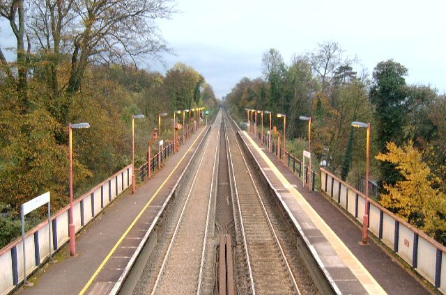
Photo: Edward, CC BY-SA 2.0.
Shoreham railway station serves Shoreham in Kent, England. It is 22 miles 52 chains down the line from London Victoria and is situated between Eynsford and Otford. Train services are provided by Thameslink. Shoreham (Kent) Railway Station is situated 1 mile northeast of Filston Farm.
Shoreham Aircraft Museum
Museum
The Shoreham Aircraft Museum is located in the village of Shoreham near Sevenoaks in Kent, England, on the south-east edge of Greater London. It was founded by volunteers in 1978 and is dedicated to the airmen who fought in the skies over southern England during the Second World War. Shoreham Aircraft Museum is situated 3,200 feet north of Filston Farm.
Church of St Peter and St Paul
Church
 Church of St Peter and St Paul is situated 3,800 feet northeast of Filston Farm.
Places in the Area
Nearby places include Shoreham and Well Hill.
Shoreham
Village

Photo: Nigel Freeman, CC BY-SA 2.0.
Shoreham is a village and civil parish in the Sevenoaks District of Kent, England. It is located 5.2 miles north of Sevenoaks. The probable derivation of the name is estate at the foot of a steep slope.
Well Hill
Village

Photo: Stacey Harris, CC BY-SA 2.0.
Well Hill is a small rural hamlet within the civil parish of Shoreham in the Sevenoaks District of Kent, England. It borders east of Orpington & 3.5 miles south of Swanley, adjacent to the Kent border with Greater London, within the constituency of Sevenoaks. Well Hill is situated 2½ miles northwest of Filston Farm.
Romney Street
Hamlet

Photo: phil elston, CC BY-SA 2.0.
Romney Street is a hamlet in the civil parish of Shoreham, in the Sevenoaks district, in the English county of Kent. Romney Street is situated 2½ miles east of Filston Farm.
Filston Farm
- Type: Farm
- Category: agriculture
- Location: Kent, South East England, England, United Kingdom, Britain and Ireland, Europe
- View on OpenStreetMap
Latitude
51.32548° or 51° 19′ 32″ northLongitude
0.17331° or 0° 10′ 24″ eastOpen location code
9F3285GF+58OpenStreetMap ID
way 216619430OpenStreetMap feature
landuse=farmyard
This page is based on OpenStreetMap, Wikidata, and Wikimedia Commons.
We’d love your help improving our open data sources. Thank you for contributing.
Satellite Map
Discover Filston Farm from above in high-definition satellite imagery.
Notable Places Nearby
Highlights include Robins Wood and The Quadrangle.
Nearby Places
Explore places such as Water Lane and Home Farm.
Kent: Must-Visit Destinations
Delve into Canterbury, Dover, Maidstone, and Rochester.
Curious Farms to Discover
Uncover intriguing farms from every corner of the globe.
About Mapcarta. Data © OpenStreetMap contributors and available under the Open Database License". Text is available under the CC BY-SA 4.0 license, except for photos, directions, and the map. Photo: Diliff, CC BY-SA 3.0.