Lower Farm
Lower Farm is a farm in Bishop’s Itchington, Stratford-on-Avon District, England. Lower Farm is situated nearby to the power station Feldon Vale Solar Farm Development Zone 5, as well as near Feldon Vale Solar Farm Development Zone 3.| Tap on a place to explore it |
Places of Interest Nearby
Highlights include Burton Dassett Hills and All Saints.
Burton Dassett Hills
Park
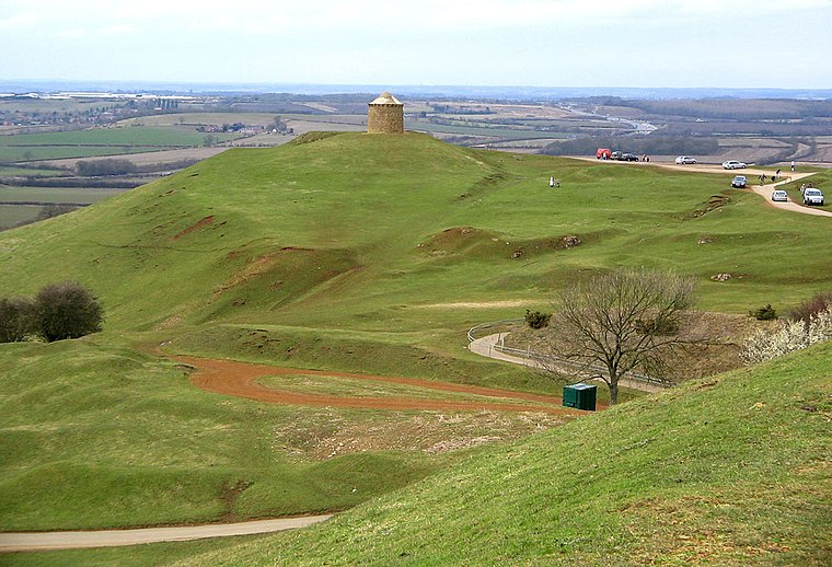
Photo: G-Man, Public domain.
Burton Dassett Hills Country Park is a country park in southeastern Warwickshire, England. It was created as a country park in 1971 and is run by Warwickshire County Council. Burton Dassett Hills is situated 2½ miles south of Lower Farm.
All Saints
Church

Photo: AJD, CC BY-SA 2.0.
All Saints is a church, which is situated 2 miles south of Lower Farm.
Church of St Giles
Church

Photo: David P Howard, CC BY-SA 2.0.
Church of St Giles is situated 2 miles southwest of Lower Farm.
Places in the Area
Nearby places include Northend and Temple Herdewyke.
Northend
Village
Northend is a village in southern-eastern Warwickshire, England, located roughly halfway between the town of Banbury and the conurbation of Leamington Spa and Warwick. Northend is situated 2 miles south of Lower Farm.
Temple Herdewyke
Village

Photo: Ian Rob, CC BY-SA 2.0.
Temple Herdewyke is a village in Warwickshire, England, that was built to house staff at Defence Munitions Kineton. It forms part of the parish of Burton Dassett. Temple Herdewyke is situated 2½ miles south of Lower Farm.
Ladbroke
Village

Photo: Ian Rob, CC BY-SA 2.0.
Ladbroke is a village and civil parish about 2 miles south of Southam in Warwickshire. The population of the civil parish at the 2001 Census was 273, reducing to 268 at the 2011 Census. Ladbroke is situated 2½ miles northeast of Lower Farm.
Lower Farm
- Type: Farm
- Category: agriculture
- Location: Bishop’s Itchington, Stratford-on-Avon District, Warwickshire, West Midlands, England, United Kingdom, Britain and Ireland, Europe
- View on OpenStreetMap
Latitude
52.19854° or 52° 11′ 55″ northLongitude
-1.42556° or 1° 25′ 32″ westOpen location code
9C4W5HXF+CQOpenStreetMap ID
way 220462384OpenStreetMap feature
landuse=farmyard
This page is based on OpenStreetMap, Wikidata, and Wikimedia Commons.
We’d love your help improving our open data sources. Thank you for contributing.
Satellite Map
Discover Lower Farm from above in high-definition satellite imagery.
Places with the Same Name
Discover other places named “Lower Farm”.
Notable Places Nearby
Highlights include Feldon Vale Solar Farm Development Zone 5 and Feldon Vale Solar Farm Development Zone 3.
Nearby Places
Explore places such as Midoak Stud and Upper Spring Farm.
Warwickshire: Must-Visit Destinations
Delve into Stratford-upon-Avon, Warwick, Rugby, and Leamington Spa.
Curious Farms to Discover
Uncover intriguing farms from every corner of the globe.
About Mapcarta. Data © OpenStreetMap contributors and available under the Open Database License". Text is available under the CC BY-SA 4.0 license, except for photos, directions, and the map. Photo: brianac37, CC BY 2.0.