Spielplatz Am Strümper Busch
Spielplatz Am Strümper Busch is a playground in Meerbusch, Rhein-Kreis Neuss, North Rhine-Westphalia. Spielplatz Am Strümper Busch is situated nearby to the school Städtisches Meerbusch-Gymnasium, as well as near the sports venue SWIM4FUN.| Tap on a place to explore it |
Places of Interest Nearby
Highlights include Städtisches Meerbusch-Gymnasium and Meerbusch-Osterath Railway Station.
Städtisches Meerbusch-Gymnasium
School

Photo: Lyzzy, CC BY-SA 3.0.
Städtisches Meerbusch-Gymnasium is a school, which is situated 110 metres east of Spielplatz Am Strümper Busch.
Meerbusch-Osterath Railway Station
Railway station
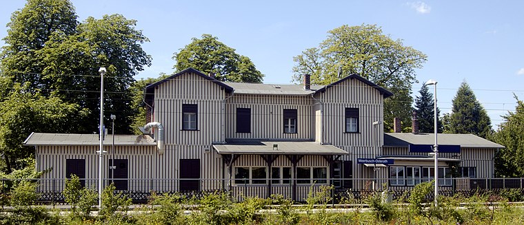
Photo: Lyzzy, CC BY-SA 3.0.
Meerbusch-Osterath is the only station in Meerbusch in the German state of North Rhine-Westphalia. It is located in the district of Osterath and lies at the Lower Left Rhine Railway and on the Osterath–Dortmund Süd railway. Meerbusch-Osterath Railway Station is situated 2 km southwest of Spielplatz Am Strümper Busch.
Evangelische Kirche (Osterath)
Church

Photo: Chris06, CC BY-SA 4.0.
Evangelische Kirche (Osterath) is a church, which is situated 2 km southwest of Spielplatz Am Strümper Busch.
Places in the Area
Nearby places include Strümp and Büderich.
Strümp
Village

Photo: Tetris L, CC BY-SA 3.0.
Strümp is one of the eight districts of the city of Meerbusch, Germany. Its name is believed to be based on the stream Strempe that runs through the town and has its spring nearby.
Büderich
Suburb

Photo: Lyzzy, CC BY-SA 3.0.
Büderich is a suburb, which is situated 4½ km southeast of Spielplatz Am Strümper Busch.
Fischeln
Suburb

Photo: Ludger1961, CC BY-SA 3.0 de.
Fischeln is the most southerly district of Krefeld, Germany. Its population is 26,030 and its area is 18.99 km2. Older than Krefeld, Fischeln was first mentioned as "Viscolo" around 900AD. Fischeln is situated 5 km northwest of Spielplatz Am Strümper Busch.
Spielplatz Am Strümper Busch
- Type: Playground
- Category: recreation area
- Location: Meerbusch, Rhein-Kreis Neuss, Düsseldorf, Lower Rhine, North Rhine-Westphalia, Germany, Central Europe, Europe
- View on OpenStreetMap
Latitude
51.27802° or 51° 16′ 41″ northLongitude
6.64801° or 6° 38′ 53″ eastOpen location code
9F387JHX+66OpenStreetMap ID
way 234321986OpenStreetMap feature
leisure=playground
This page is based on OpenStreetMap, Wikidata, and Wikimedia Commons.
We’d love your help improving our open data sources. Thank you for contributing.
Satellite Map
Discover Spielplatz Am Strümper Busch from above in high-definition satellite imagery.
Notable Places Nearby
Highlights include Städtisches Meerbusch-Gymnasium Sporthallen and SWIM4FUN.
Nearby Places
Explore places such as Schulparkplatz and Segment Of Berlin Wall.
Lower Rhine: Must-Visit Destinations
Delve into Düsseldorf, Mönchengladbach, Krefeld, and Neuss.
Curious Playgrounds to Discover
Uncover intriguing playgrounds from every corner of the globe.
About Mapcarta. Data © OpenStreetMap contributors and available under the Open Database License". Text is available under the CC BY-SA 4.0 license, except for photos, directions, and the map. Photo: Wikimedia, CC0.