Flagge
Flagge is a second-hand shop in Emmerich am Rhein, Kleve, North Rhine-Westphalia which is located on Steinstraße. Flagge is situated nearby to the government office Sozialamt, as well as near Bürgerbüro.| Tap on a place to explore it |
Places of Interest Nearby
Highlights include Stadtbücherei Emmerich and Rheinmuseum Emmerich.

Rheinmuseum Emmerich
Museum
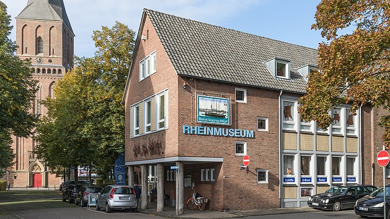
Photo: Wikimedia, CC BY-SA 4.0.
Rheinmuseum Emmerich is situated 140 metres northwest of Flagge.
Christ church
Church

Photo: Wikimedia, CC BY-SA 4.0.
Christ church is situated 170 metres northwest of Flagge.
Places in the Area
Nearby places include Leegmeer and Klein-Netterden.

Klein-Netterden
Village

Photo: Pelikana, CC BY-SA 4.0.
Klein-Netterden is a village, which is situated 2½ km northeast of Flagge.
Vrasselt
Village

Photo: Michielverbeek, CC BY-SA 3.0.
Vrasselt is a village, which is situated 5 km east of Flagge.
Flagge
- Type: Second-hand shop
- Address: Steinstraße 39, Emmerich am Rhein, 46446
- Categories: building, shop, and apartment building
- Location: Emmerich am Rhein, Kleve, Düsseldorf, Lower Rhine, North Rhine-Westphalia, Germany, Central Europe, Europe
- View on OpenStreetMap
Latitude
51.83074° or 51° 49′ 51″ northLongitude
6.23922° or 6° 14′ 21″ eastLevels
4Open location code
9F38R6JQ+7MOpenStreetMap ID
way 237440808OpenStreetMap feature
building=apartmentsOpenStreetMap feature
shop=second_hand
This page is based on OpenStreetMap, Wikidata, and Wikimedia Commons.
We’d love your help improving our open data sources. Thank you for contributing.
Satellite Map
Discover Flagge from above in high-definition satellite imagery.
Notable Places Nearby
Highlights include Sozialamt and Bürgerbüro.
Nearby Places
Explore places such as Vintage Circle and Dentaltechnik Johannes Coman.
Lower Rhine: Must-Visit Destinations
Delve into Düsseldorf, Mönchengladbach, Krefeld, and Neuss.
Curious Second-Hand Shops to Discover
Uncover intriguing second-hand shops from every corner of the globe.
About Mapcarta. Data © OpenStreetMap contributors and available under the Open Database License". Text is available under the CC BY-SA 4.0 license, except for photos, directions, and the map. Photo: Maparial, CC BY-SA 3.0.