P+R
P+R is a parking area in Mönchengladbach, Düsseldorf, North Rhine-Westphalia. P+R is situated nearby to the dog park Hundeplatz GHV Altstadt / MG-Bettrath e.V., as well as near Reitverein Sankt Georg.| Tap on a place to explore it |
Places of Interest Nearby
Highlights include Church of the Assumption (Neuwerk-Mitte) and Convent church Neuwerk.
Church of the Assumption (Neuwerk-Mitte)
Church

Photo: Chris06, CC BY-SA 4.0.
Church of the Assumption (Neuwerk-Mitte) is situated 2 km southeast of P+R.
Convent church Neuwerk
Church

Photo: Wikimedia, CC BY-SA 3.0 de.
Convent church Neuwerk is situated 2 km southeast of P+R.
Neuwerk Nunnery
Monastery

Photo: Chris06, CC BY-SA 4.0.
Neuwerk Nunnery is a monastery, which is situated 2 km southeast of P+R.
Places in the Area
Nearby places include Lockhütte and Neersen.

Neersen
Suburb
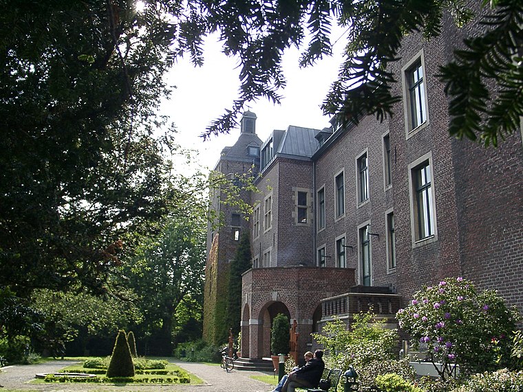
Photo: Historiograf, CC BY 2.0.
Neersen is a suburb, which is situated 3 km northeast of P+R.
Robend
Suburb

Photo: Þomas, CC BY-SA 3.0.
Robend is a suburb, which is situated 3½ km northwest of P+R.
P+R
- Type: Parking area
- Category: transportation
- Location: Mönchengladbach, Düsseldorf, Lower Rhine, North Rhine-Westphalia, Germany, Central Europe, Europe
- View on OpenStreetMap
Latitude
51.23478° or 51° 14′ 5″ northLongitude
6.45207° or 6° 27′ 8″ eastOpen location code
9F386FM2+WROpenStreetMap ID
way 23815335OpenStreetMap feature
amenity=parking
This page is based on OpenStreetMap, Wikidata, and Wikimedia Commons.
We’d love your help improving our open data sources. Thank you for contributing.
Satellite Map
Discover P+R from above in high-definition satellite imagery.
Notable Places Nearby
Highlights include Hundeplatz GHV Altstadt / MG-Bettrath e.V. and Reitverein Sankt Georg.
Nearby Places
Explore places such as Jakobs Hütte and Ponyclub Nettetal.
Lower Rhine: Must-Visit Destinations
Delve into Düsseldorf, Krefeld, Neuss, and Kleve.
Curious Parking Areas to Discover
Uncover intriguing parking areas from every corner of the globe.
About Mapcarta. Data © OpenStreetMap contributors and available under the Open Database License". Text is available under the CC BY-SA 4.0 license, except for photos, directions, and the map. Photo: CaS2000, CC BY-SA 3.0 de.