Heilbronn Kanalbrücke
Heilbronn Kanalbrücke is in Heilbronn, Stuttgart, Baden-Württemberg. Heilbronn Kanalbrücke is situated nearby to the bridge Otto-Konz-Brücke, as well as near the park Klimawäldchen Heilbronn 2.| Tap on a place to explore it |
Places of Interest Nearby
Highlights include Heilbronn Hauptbahnhof and Schießhaus.
Heilbronn Hauptbahnhof
Railway station

Photo: Randy43, Public domain.
Heilbronn Hauptbahnhof is the main passenger railway station in Heilbronn in the German state of Baden-Württemberg. Heilbronn Hauptbahnhof is situated 720 metres northeast of Heilbronn Kanalbrücke.
Schießhaus
Historic building

Photo: Randy43, CC BY-SA 3.0.
Schießhaus is a historic building, which is situated 570 metres east of Heilbronn Kanalbrücke.
Frankenstadion Heilbronn
Stadium
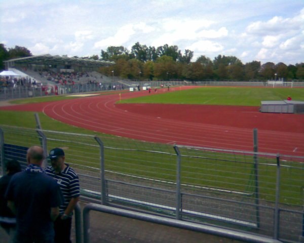
Photo: Ampfinger, CC BY-SA 3.0.
Frankenstadion Heilbronn is a multi-use stadium in Heilbronn, Germany. It is currently used mostly for football matches and is the home stadium of FC Heilbronn. The stadium is able to hold 17,200 people. Frankenstadion Heilbronn is situated 700 metres southeast of Heilbronn Kanalbrücke.
Places in the Area
Nearby places include Sontheim and Heilbronn-Frankenbach.
Sontheim
Suburb

Photo: Wikimedia, CC BY-SA 3.0.
Sontheim is a suburb, which is situated 2½ km south of Heilbronn Kanalbrücke.
Heilbronn-Frankenbach
Suburb

Photo: Schmelzle, CC BY-SA 4.0.
Frankenbach has been a borough of Heilbronn, Baden-Wüttemberg, since 1974. It is situated in the North-West, about 4.5 kilometres as crow flies from the centre. Heilbronn-Frankenbach is situated 3 km northwest of Heilbronn Kanalbrücke.
Badener Hof
Neighborhood

Photo: Rosenzweig, CC BY-SA 3.0.
Badener Hof is a neighborhood, which is situated 3½ km east of Heilbronn Kanalbrücke.
Heilbronn Kanalbrücke
- Type: Railway
- Category: transportation
- Location: Heilbronn, Stuttgart, Rhine-Neckar, Baden-Württemberg, Germany, Central Europe, Europe
- View on OpenStreetMap
Latitude
49.14042° or 49° 8′ 26″ northLongitude
9.19873° or 9° 11′ 55″ eastOpen location code
8FXF45RX+5FOpenStreetMap ID
way 238264915OpenStreetMap feature
landuse=railway
This page is based on OpenStreetMap, Wikidata, and Wikimedia Commons.
We’d love your help improving our open data sources. Thank you for contributing.
Satellite Map
Discover Heilbronn Kanalbrücke from above in high-definition satellite imagery.
Notable Places Nearby
Highlights include Klimawäldchen Heilbronn 2 and Otto-Konz-Brücke.
Nearby Places
Explore places such as Schaltposten Heilbronn and Radfahrer-Information.
Rhine-Neckar: Must-Visit Destinations
Delve into Heidelberg, Karlsruhe, Mannheim, and Sinsheim.
Curious Places to Discover
Uncover intriguing places from every corner of the globe.
About Mapcarta. Data © OpenStreetMap contributors and available under the Open Database License". Text is available under the CC BY-SA 4.0 license, except for photos, directions, and the map. Photo: Nastoshka, CC BY-SA 3.0.