Freiwillige Feuerwehr Biebertal
Freiwillige Feuerwehr Biebertal is a fire station in Fronhofen, Rhein-Hunsrück-Kreis, Rhineland-Palatinate. Freiwillige Feuerwehr Biebertal is situated nearby to the pond Brandweiher, as well as near the village Biebern.| Tap on a place to explore it |
Places of Interest Nearby
Highlights include Nannhausen Airfield and Herzog-Johann-Gymnasium.
Nannhausen Airfield
Aerodrome

Photo: Carsten Steger, CC BY-SA 4.0.
Nannhausen Airfield is a small airstrip in Nannhausen, Germany. It is located along the B50 between Simmern and Kirchberg and is close to the much larger Frankfurt Hahn Airport. It has a single grass runway in the direction 06 / 24 with a length of 560 meters. Nannhausen Airfield is situated 2½ km southeast of Freiwillige Feuerwehr Biebertal.
Herzog-Johann-Gymnasium
School
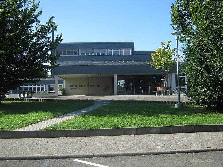
Photo: Prankster, Public domain.
Herzog-Johann-Gymnasium is a school, which is situated 4 km east of Freiwillige Feuerwehr Biebertal.
Places in the Area
Nearby places include Biebern and Nannhausen.
Biebern
Village

Photo: Swansonville, Public domain.
Biebern is an Ortsgemeinde – a municipality belonging to a Verbandsgemeinde, a kind of collective municipality – in the Rhein-Hunsrück-Kreis in Rhineland-Palatinate, Germany. It belongs to the Verbandsgemeinde Simmern-Rheinböllen, whose seat is in Simmern.
Nannhausen
Village

Photo: Prankster, Public domain.
Nannhausen is an Ortsgemeinde – a municipality belonging to a Verbandsgemeinde, a kind of collective municipality – in the Rhein-Hunsrück-Kreis in Rhineland-Palatinate, Germany. It belongs to the Verbandsgemeinde Simmern-Rheinböllen, whose seat is in Simmern.
Reich
Village

Photo: Wikimedia, Public domain.
Reich is an Ortsgemeinde – a municipality belonging to a Verbandsgemeinde, a kind of collective municipality – in the Rhein-Hunsrück-Kreis in Rhineland-Palatinate, Germany. It belongs to the Verbandsgemeinde Simmern-Rheinböllen, whose seat is in Simmern. Reich is situated 2½ km northwest of Freiwillige Feuerwehr Biebertal.
Freiwillige Feuerwehr Biebertal
- Type: Fire station
- Category: building
- Location: Fronhofen, Rhein-Hunsrück-Kreis, Rhineland-Palatinate, Germany, Central Europe, Europe
- View on OpenStreetMap
Latitude
49.99163° or 49° 59′ 30″ northLongitude
7.46333° or 7° 27′ 48″ eastOpen location code
8FX9XFR7+M8OpenStreetMap ID
way 238554350OpenStreetMap feature
amenity=fire_stationOpenStreetMap feature
building=yes
This page is based on OpenStreetMap, Wikidata, and Wikimedia Commons.
We’d love your help improving our open data sources. Thank you for contributing.
Satellite Map
Discover Freiwillige Feuerwehr Biebertal from above in high-definition satellite imagery.
Places with the Same Name
Discover other places named “Freiwillige Feuerwehr Biebertal”.
Notable Places Nearby
Highlights include Brandweiher and Gemeindehaus Nannhausen.
Nearby Places
Explore places such as Fronhofen Hauptstr. and Fronhofen Haupstr..
Rhineland-Palatinate: Must-Visit Destinations
Delve into Mainz, Trier, Koblenz, and Worms.
Curious Fire Stations to Discover
Uncover intriguing fire stations from every corner of the globe.
About Mapcarta. Data © OpenStreetMap contributors and available under the Open Database License". Text is available under the CC BY-SA 4.0 license, except for photos, directions, and the map. Photo: Traveler100, CC BY-SA 3.0.