بلدية منطقة نجران
بلدية منطقة نجران is a building in Najran Region, Saudi Arabia which is located on king Abdullaziz St. بلدية منطقة نجران is situated nearby to the hospital مستوصف العطفين, as well as near the mosque جامع الامام البخاري.| Tap on a place to explore it |
Places in the Area
Nearby places include Najran.
Najran
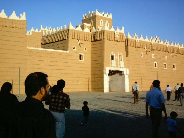
Photo: Irshadpp, CC BY-SA 3.0.
Najran, is a city in southwestern Saudi Arabia. It is the capital of Najran Province. Today, the city of Najran is one of the fastest-growing cities in the kingdom of Saudi Arabia.
بلدية منطقة نجران
- Type: Building
- Address: king Abdullaziz St, Najran, 4198
- Location: Najran Region, Saudi Arabia, Middle East, Asia
- View on OpenStreetMap
Latitude
17.52392° or 17° 31′ 26″ northLongitude
44.1989° or 44° 11′ 56″ eastOpen location code
7H96G5FX+HHOpenStreetMap ID
way 242496978OpenStreetMap feature
building=yes
This page is based on OpenStreetMap, Wikidata, and Wikimedia Commons.
We’d love your help improving our open data sources. Thank you for contributing.
Satellite Map
Discover بلدية منطقة نجران from above in high-definition satellite imagery.
Notable Places Nearby
Highlights include مستوصف العطفين and جامع الامام البخاري.
Nearby Places
Explore places such as سوق الفيصلية المركزي and حياة نجران.
Saudi Arabia: Must-Visit Destinations
Delve into Mecca, Riyadh, Medina, and Jeddah.
Curious Buildings to Discover
Uncover intriguing buildings from every corner of the globe.
About Mapcarta. Data © OpenStreetMap contributors and available under the Open Database License". Text is available under the CC BY-SA 4.0 license, except for photos, directions, and the map. Photo: Mardetanha, CC BY-SA 3.0.