Kläranlage Mittleres Kylltal
Kläranlage Mittleres Kylltal is a wastewater treatment plant in Auw an der Kyll, Bitburg-Prüm, Rhineland-Palatinate. Kläranlage Mittleres Kylltal is situated nearby to the church St. Nikolaus, as well as near the fire station Freiwillige Feuerwehr Auw.| Tap on a place to explore it |
Places of Interest Nearby
Highlights include St. Petrus.
St. Petrus
Church
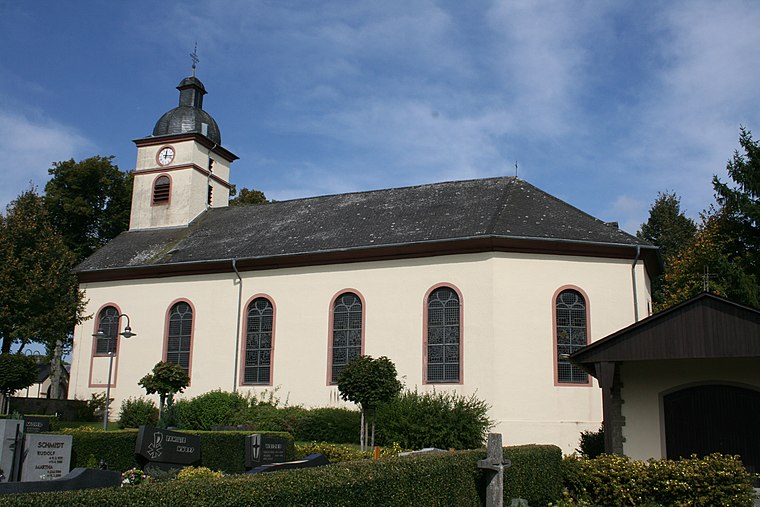
Photo: Weides Reinhard, Copyrighted free use.
St. Petrus is a church, which is situated 3½ km northwest of Kläranlage Mittleres Kylltal.
Places in the Area
Nearby places include Hosten and Preist.
Hosten
Village

Photo: CTHOE, CC BY-SA 4.0.
Hosten is a municipality in the district of Bitburg-Prüm, in Rhineland-Palatinate, western Germany.
Preist
Village

Photo: Wikimedia, CC BY-SA 3.0.
Preist is a municipality in the district of Bitburg-Prüm, in Rhineland-Palatinate, western Germany.
Dahlem
Village

Photo: Heckos89, CC BY-SA 3.0.
Dahlem is a municipality in the district of Bitburg-Prüm, in Rhineland-Palatinate, western Germany.
Kläranlage Mittleres Kylltal
- Type: Wastewater treatment plant
- Category: industry
- Location: Auw an der Kyll, Bitburg-Prüm, Rhineland-Palatinate, Germany, Central Europe, Europe
- View on OpenStreetMap
Latitude
49.89664° or 49° 53′ 48″ northLongitude
6.60639° or 6° 36′ 23″ eastOpen location code
8FX8VJW4+MHOpenStreetMap ID
way 242988608OpenStreetMap feature
man_made=wastewater_plant
This page is based on OpenStreetMap, Wikidata, and Wikimedia Commons.
We’d love your help improving our open data sources. Thank you for contributing.
Satellite Map
Discover Kläranlage Mittleres Kylltal from above in high-definition satellite imagery.
Notable Places Nearby
Highlights include St. Nikolaus and Freiwillige Feuerwehr Auw.
Nearby Places
Explore places such as Stille Aussicht and Haus Wollersheck.
Rhineland-Palatinate: Must-Visit Destinations
Delve into Mainz, Trier, Koblenz, and Worms.
Curious Wastewater Treatment Plants to Discover
Uncover intriguing wastewater treatment plants from every corner of the globe.
About Mapcarta. Data © OpenStreetMap contributors and available under the Open Database License". Text is available under the CC BY-SA 4.0 license, except for photos, directions, and the map. Photo: Traveler100, CC BY-SA 3.0.