P+R
P+R is a parking area in Remagen, Bad Neuenahr-Ahrweiler, Rhineland-Palatinate. P+R is situated nearby to the railway station Remagen station, as well as near the community center Jugendbahnhof Remagen.| Tap on a place to explore it |
Places of Interest Nearby
Highlights include Remagen station and Martinsbrunnen.
Remagen station
Railway station
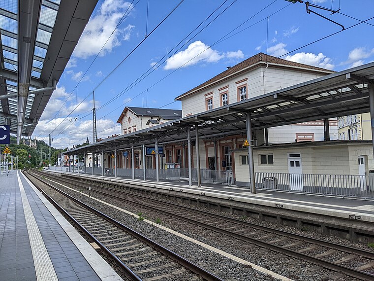
Photo: Tohma, CC BY-SA 4.0.
Remagen station is on the Left Rhine line in the city of Remagen in the German state of Rhineland-Palatinate. It is classified by Deutsche Bahn as a category 4 station.
Martinsbrunnen
Work of art

Photo: Gerd Fahrenhorst, CC BY 4.0.
Martinsbrunnen is a work of art, which is situated 130 metres north of P+R.
Friedenskirche
Church

Photo: Wikimedia, CC BY-SA 4.0.
Friedenskirche is a church, which is situated 300 metres east of P+R.
Places in the Area
Nearby places include Erpel and Orsberg.
Erpel
Village

Photo: Steffen 962, CC BY-SA 4.0.
Erpel is a municipality in the district of Neuwied, in Rhineland-Palatinate, Germany.


P+R
- Type: Parking area
- Parking: surface
- Category: transportation
- Location: Remagen, Bad Neuenahr-Ahrweiler, Eifel, Rhineland-Palatinate, Germany, Central Europe, Europe
- View on OpenStreetMap
Latitude
50.57672° or 50° 34′ 36″ northLongitude
7.22995° or 7° 13′ 48″ eastOperator
Stadt RemagenOpen location code
9F29H6GH+MXOpenStreetMap ID
way 24314636OpenStreetMap feature
amenity=parkingOpenStreetMap attribute
parking=surface
This page is based on OpenStreetMap, Wikidata, and Wikimedia Commons.
We’d love your help improving our open data sources. Thank you for contributing.
Satellite Map
Discover P+R from above in high-definition satellite imagery.
Notable Places Nearby
Highlights include Jugendbahnhof Remagen and Maisons-Laffitte-Platz.
Nearby Places
Explore places such as Remagen Bahnhof and Remagen.
Eifel: Must-Visit Destinations
Delve into Bitburg, Mayen, Nürburg, and Dernau.
Curious Parking Areas to Discover
Uncover intriguing parking areas from every corner of the globe.
About Mapcarta. Data © OpenStreetMap contributors and available under the Open Database License". Text is available under the CC BY-SA 4.0 license, except for photos, directions, and the map. Photo: Thilver, CC BY-SA 4.0.