Barwell
Barwell is a house in South Australia, Australia. Barwell is situated nearby to the recreation area Kingsley Avenue Reserve, as well as near the post office Australia Post.| Tap on a place to explore it |
Places of Interest Nearby
Highlights include Burnside Village and Burnside Library.
Burnside Village
Shopping center
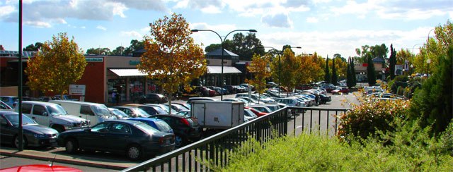
Photo: Beneaththelandslide, CC BY 2.5.
Burnside Village is a premium shopping centre located in the suburb of Glenside in Adelaide, South Australia. It is situated within the City of Burnside local government area. Burnside Village is situated 450 metres north of Barwell.
Burnside Library
Library
The Burnside Library is a public library in the City of Burnside, Adelaide. Located on the corner of Greenhill and Portrush Roads, it is part of the Burnside Civic Centre. Burnside Library is situated 700 metres north of Barwell.
Glenunga International High School
School
Glenunga International High School, formerly Glenunga High School, is a publicly-funded international school in Adelaide, South Australia. It is located approximately 4 km south-east of the Adelaide city centre in the suburb of Glenunga, between L'Estrange and Conyngham Streets, adjoining the major thoroughfare Glen Osmond Road. Glenunga International High School is situated 1 km southwest of Barwell.
Places in the Area
Nearby places include Linden Park and Glenunga.
Linden Park
Suburb

Photo: Orderinchaos, CC BY-SA 3.0.
Linden Park is a suburb of Adelaide, South Australia in the City of Burnside. It derives its name from the Linden tree. Linden Park was created when an existing allotment was subdivided and sold for housing in 1882.
Glenunga
Suburb
Glenunga is an inner southeastern suburb of Adelaide, the capital of South Australia. It is located in the City of Burnside, five kilometres southeast of the Adelaide city centre.
Glenside
Suburb
Glenside is a suburb in the local government area of the City of Burnside, Adelaide, South Australia. The suburb is 4.9 kilometres south-east of the Adelaide city centre, home to 2,852 people in a total land area of 1.40 km2.
Barwell
- Type: House
- Address: 469
- Categories: building and residential building
- Location: South Australia, Australia, Oceania
- View on OpenStreetMap
Latitude
-34.94488° or 34° 56′ 42″ southLongitude
138.64246° or 138° 38′ 33″ eastLevels
3Open location code
4QQW3J4R+2XOpenStreetMap ID
way 250488881OpenStreetMap feature
building=house
This page is based on OpenStreetMap, Wikidata, and Wikimedia Commons.
We’d love your help improving our open data sources. Thank you for contributing.
Satellite Map
Discover Barwell from above in high-definition satellite imagery.
Places with the Same Name
Discover other places named “Barwell”.
Notable Places Nearby
Highlights include Kingsley Avenue Reserve and Australia Post.
Nearby Places
Explore places such as Stop 12 Portrush Road - East side and Barwell.
South Australia: Must-Visit Destinations
Delve into Adelaide, Ikara-Flinders Ranges National Park, Dhilba Guuranda–Innes National Park, and Kangaroo Island.
Curious Houses to Discover
Uncover intriguing houses from every corner of the globe.
About Mapcarta. Data © OpenStreetMap contributors and available under the Open Database License". Text is available under the CC BY-SA 4.0 license, except for photos, directions, and the map. Photo: Roumpf, CC BY-SA 4.0.