Nagole Institute Of Technology & Science
Nagole Institute Of Technology & Science is a college in Uppal, Medchal Malkajgiri, Telangana. Nagole Institute Of Technology & Science is situated nearby to the government office Mee Seva, as well as near the marketplace Saturday Market.| Tap on a place to explore it |
Places of Interest Nearby
Highlights include Rajiv Gandhi International Cricket Stadium and Nagole metro station.
Rajiv Gandhi International Cricket Stadium
Stadium
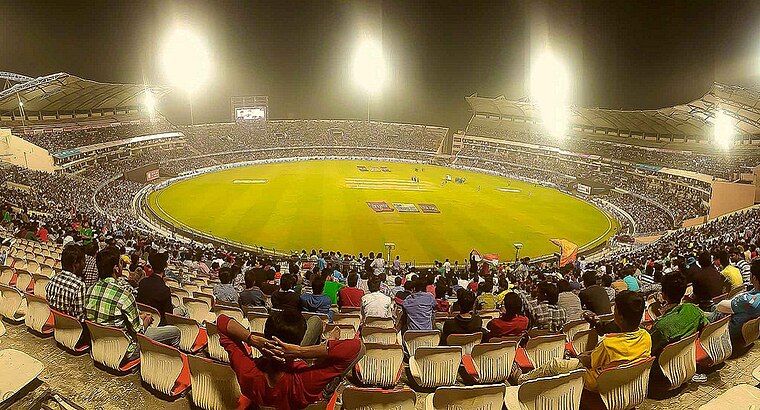
Photo: Jms1241, CC BY-SA 4.0.
The Rajiv Gandhi International Cricket Stadium, commonly known as Uppal Stadium, is an international cricket stadium in Hyderabad, Telangana, India. It is owned and operated by Hyderabad Cricket Association. Rajiv Gandhi International Cricket Stadium is situated 3½ km north of Nagole Institute Of Technology & Science.
Nagole metro station
Metro station
Nagole metro station is located on the Blue Line of the Hyderabad Metro in India, in the state of Telangana. It is near to HMR Uppal Depot, Metro Cash and Carry, RTA, HDFC bank ATM, ICICI Bank ATM and JayaChandra Gardens. Nagole metro station is situated 2 km north of Nagole Institute Of Technology & Science.
Victoria Memorial metro station
Metro station
The Victoria Memorial Metro Station is located on the Red Line of the Hyderabad Metro, India. It is part of Corridor I of Hyderabad metro starting from Miyapur and was opened to public on 24 September 2018. Victoria Memorial metro station is situated 2½ km southwest of Nagole Institute Of Technology & Science.
Places in the Area
Nearby places include Nagole and Vasavi Colony.
Nagole
Suburb
Nagole is a residential and commercial locality in Uppal mandal mostly owned by Koduri family, Medchal district, Telangana, India.
Vasavi Colony
Neighborhood
Dilsukhnagar is a commercial and residential neighborhood in Hyderabad, Telangana. One of the largest areas of the city, it is governed by the Greater Hyderabad Municipal Corporation.
East Hyderabad
East Hyderabad consists of the eastern suburbs of Hyderabad. According to the Greater Hyderabad Municipal Corporation, it consists of Kapra, Uppal, Hayatnagar, L.B.Nagar and Saroornagar circles.Nagole Institute Of Technology & Science
- Type: College
- Category: education
- Location: Uppal, Medchal Malkajgiri, Telangana, Southern India, India, South Asia, Asia
- View on OpenStreetMap
Latitude
17.37443° or 17° 22′ 28″ northLongitude
78.56155° or 78° 33′ 42″ eastElevation
1 metre (3 feet)Open location code
7J9W9HF6+QJOpenStreetMap ID
way 252414622OpenStreetMap feature
amenity=college
This page is based on OpenStreetMap, Wikidata, and Wikimedia Commons.
We’d love your help improving our open data sources. Thank you for contributing.
Satellite Map
Discover Nagole Institute Of Technology & Science from above in high-definition satellite imagery.
Notable Places Nearby
Highlights include Sri Chaitanya Junior College and Mee Seva.
Nearby Places
Explore places such as More and sri chaitanya.
Telangana: Must-Visit Destinations
Delve into Hyderabad, Central Hyderabad, Adilabad, and Nizamabad.
Curious Colleges to Discover
Uncover intriguing colleges from every corner of the globe.
About Mapcarta. Data © OpenStreetMap contributors and available under the Open Database License". Text is available under the CC BY-SA 4.0 license, except for photos, directions, and the map. Photo: Pranayraj1985, CC BY-SA 4.0.